1970s Maps of Taylor County, Wisconsin
Explore 22 historic maps of Taylor County from the 1970s. These maps offer a rare glimpse into what life looked like during the 1970s — showing old roads, neighborhoods, homes, and landmarks that have changed or disappeared over time.
Whether you're researching your family's past, planning a metal detecting trip, or studying how Taylor County's landscape evolved across the 1970s, these high-resolution maps are a powerful tool for exploring the history of this region.
- Focus on a specific era: All maps on this page are from the 1970s, giving you a focused view of this time period.
- See what’s changed: Compare century-old streets, trails, and buildings to today's modern landscape using overlays and satellite layers.
- Research with precision: Use these maps for genealogy, historical research, land use analysis, or educational projects.
- View, download, or print: Maps are fully viewable online in high resolution, and can be downloaded or printed for your own records.
Start exploring Taylor County's history through authentic maps from the 1970s. This is your window into the past.
Taylor County, WI maps
(22)- 1970 Map of Westboro, 1972 Print
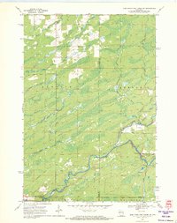
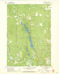
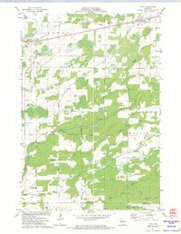
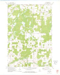
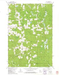
 1970 Westboro1972 Print · USGSTaylor County's northwoods were transitioning in the 1970s, as traditional rail activity met the expanding public lands of the Chequamegon National Forest. Trace family histories near Westboro and Chelsea, locating Mount Olive Cem and the Old Railroad Grade through the timber.2 unique versions available
 - 1970 Map of Jump River Fire Tower NW, 1972 Print
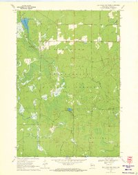
 1970 Jump River Fire Tower NW1972 Print · USGSThe Northwoods of Rusk and Price counties are documented here in the early 1970s, showing a landscape shaped by winding river systems and old timber routes. Trace the path of the Old Railroad Grade or locate historic recreation spots like Big Falls and Big Falls Campground.3 unique versions available
 - 1970 Map of Ogema, 1972 Print
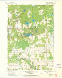
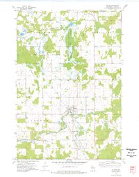
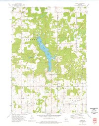
 1970 Ogema1972 Print · USGSPrice and Taylor counties come into focus in the early 1970s, centered on the millpond and rail-side settlements of the Wisconsin Northwoods. Genealogists and local historians can trace family locations along Hallstrand Road, visit Hillside Cem, or locate the old Townhall and Mackeys Spur.
 - 1970 Map of Medford NW, 1972 Print
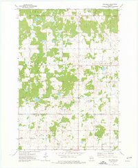
 1970 Medford NW1972 Print · USGSTaylor County's timber and lake country is captured here during the 1970s, showcasing the transition from early industry to modern recreation. Locate defunct infrastructure along the Old Railroad Grade or trace family roots at Molitor Cem and Brookside Sch.2 unique versions available
 - 1970 Map of Jump River Fire Tower NE, 1972 Print
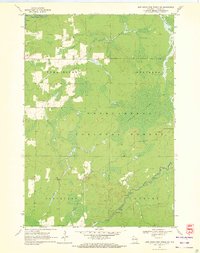
 1970 Jump River Fire Tower NE1972 Print · USGSThe confluence of the Jump River forks in northern Wisconsin is captured here during the early seventies, spanning the Price and Taylor county line. Outdoorsmen and local historians can trace the bounds of the Township Corners State Wildlife Management Area and find named river landmarks like Big Falls and Steve Creek Flowage.
 - 1970 Map of Jump River Fire Tower SW, 1972 Print
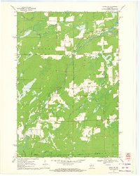
 1970 Jump River Fire Tower SW1972 Print · USGSTaylor County forest lands and river valleys are captured here in the early 1970s. Local historians can trace the Old Railroad Grade and identify the numerous rapids along the Jump River and Yellow River.2 unique versions available
 - 1970 Map of Ogema NW, 1972 Print
 1970 Ogema NW1972 Print · USGSThe river forks and rural corridors of Price County are captured here in the early seventies as the landscape transitioned into the modern era. Genealogists and historians can trace the Fourth Principal Meridian and locate landmarks like Hallberg Hill and South Fork Jump River.2 unique versions available
 - 1970 Map of Mondeaux Dam, 1972 Print
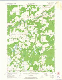
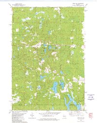
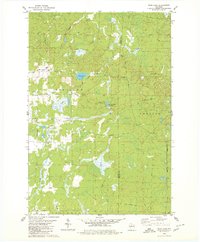
 1970 Mondeaux Dam1972 Print · USGSWisconsin’s Northwoods are showcased here in the early 1970s, focused on the recreation and timber lands of the Chequamegon National Forest. Researchers can trace the Old Railroad Grade or locate historic campsites like Camp 11 and the Mondeaux Dam.2 unique versions available
 - 1970 Map of Jump River Fire Tower, 1972 Print
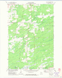
 1970 Jump River Fire Tower1972 Print · USGSTaylor County's deep woods and water networks are captured here in the early seventies, spanning the borders of Westboro and Molitor. Researchers can trace the hydrography of the Upper Silver Creek Flowage and locate landmarks like the Jump River Fire Tower and Lost Lake.
 - 1971 Map of Jump River, 1974 Print
 1971 Jump River1974 Print · USGSJump River and Hannibal are documented in the early 1970s as this Taylor County landscape transitioned toward conservation and wildlife management. Researchers can trace the Old Railroad Grade, locate the Mt Nebo Cem, and see the extent of the Monson Flowage.
 - 1971 Map of Sheldon, 1974 Print
 1971 Sheldon1974 Print · USGSSheldon and Donald are shown in the early 1970s at the junction of the Jump and Little Jump Rivers. Local researchers can trace community landmarks like the Mennonite Ch, the Fairground, and the path of the SOO LINE RAILROAD.
 - 1971 Map of Tony, 1974 Print
 1971 Tony1974 Print · USGSThe railroad towns of Tony and Glen Flora anchor this Rusk County landscape in the early 1970s, where the SOO LINE tracks cut across a dense network of river forks. Local researchers can trace rural developments along Progressive Road and the many branches of Main Creek.2 unique versions available
 - 1971 Map of Sheldon NE, 1974 Print
 1971 Sheldon NE1974 Print · USGSRusk and Taylor Counties in the early 1970s reveal a landscape of winding river systems and small civic outposts. Genealogists and local historians can locate the South Lawrence Cemetery, the Townhall, and traces of an Old Railroad Grade.
 - 1973 Map of Gilman, 1976 Print
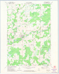
 1973 Gilman1976 Print · USGSIn the early 1970s, this Taylor County landscape centered on Gilman and the winding Yellow River. Researchers can trace old transportation corridors along the Soo Line Railroad and the Old Railroad Grade or locate family plots at Meadowbrook Cem.2 unique versions available
 - 1973 Map of Bellinger, 1976 Print
 1973 Bellinger1976 Print · USGSTaylor and Clark counties are captured here in the early 1970s, showing a transition from the logging era to a quiet rural landscape. Researchers can trace the Old Railroad Grade and locate local landmarks like the Ukrainian Orthodox Ch and the settlement of Bellinger.
 - 1973 Map of Ruby, 1976 Print
 1973 Ruby1976 Print · USGSChippewa and Taylor counties in the early 1970s reveal a landscape of vast wetlands and managed wilderness. Genealogists and local historians can locate the Yellow River Cem and St Johns Ch near the banks of the Yellow River.
 - 1973 Map of Huron, 1976 Print
 1973 Huron1976 Print · USGSWisconsin's lake country in the early 1970s is shown here at the intersection of Chippewa, Taylor, and Clark counties. Researchers can trace the Old Railroad Grade near Brownville or locate local landmarks like the Gilman Lookout Tower and Huron.
 - 1979 Map of Timms Hill, 1980 Print
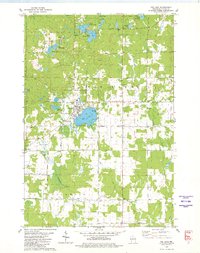
 1979 Timms Hill1980 Print · USGSThe Wisconsin Northwoods are captured here in the late seventies, centered on the state's highest elevation. Local historians can locate the Garden of Memory Church, trace old routes like Goetzke Road, and explore the shoreline of Spirit Lake.2 unique versions available
 - 1979 Map of Rib Lake, 1980 Print
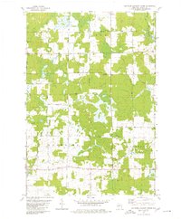
 1979 Rib Lake1980 Print · USGSThe village of Rib Lake and its surrounding lake-dotted landscape are documented here in the late seventies. Family historians and local researchers can trace sites like Lake View Cem, the rural St Ann Ch, and the defunct Old Railroad Grade.
 - 1979 Map of Spirit, 1980 Print
 1979 Spirit1980 Print · USGSThe township of Spirit and its surrounding rural countryside are captured in the late seventies as a community of small farms and timberlands. Local historians can trace old homestead access via Settlement Road, visit the Hillcrest Cem, and locate the Old Railroad Grade near Squaw Creek.2 unique versions available
 - 1979 Map of Wood Lake, 1980 Print
 1979 Wood Lake1980 Print · USGSTaylor and Lincoln Counties appear in the late seventies as a landscape of timber-era remnants and sprawling wetlands. Genealogists and historians can trace the Old Railroad Grade and Old RR GR through the terrain near Wood Lake and Camp Eight Flowage.2 unique versions available
 - 1979 Map of Rib River Lookout Tower, 1980 Print
 1979 Rib River Lookout Tower1980 Print · USGSTaylor County farmland and forests are documented here in the late seventies, showing the rural structure of the Greenwood and Browning townships. Genealogists and historians can locate rural landmarks like St Peter Ch, Cloverdale Sch, and the Rib River Lookout Tower.2 unique versions available
End of results
Showing maps 1-22 of 22
Top cities of Taylor County
- Medford historical maps
- Little Black historical maps
- Rib Lake historical maps
- Chelsea historical maps
- Westboro historical maps
- Stetsonville historical maps
See more
Frequently asked questions
- What are the different types of historical maps available for Taylor County?
- What is the oldest map of Taylor County?
- Where can I purchase historical maps of Taylor County for my home or office?
- Where can I download high-res historical maps of Taylor County?
- Are there historical topographic maps available for Taylor County?
- Is there historical aerial imagery available for Taylor County?
- Where are historical maps of Taylor County sourced from?