2020s Maps of Chelsea, Wisconsin
Explore 4 historic maps of Chelsea from the 2020s. These maps offer a rare glimpse into what life looked like during the 2020s — showing old roads, neighborhoods, homes, and landmarks that have changed or disappeared over time.
Whether you're researching your family's past, planning a metal detecting trip, or studying how Chelsea's landscape evolved across the 2020s, these high-resolution maps are a powerful tool for exploring the history of this region.
- Focus on a specific era: All maps on this page are from the 2020s, giving you a focused view of this time period.
- See what’s changed: Compare century-old streets, trails, and buildings to today's modern landscape using overlays and satellite layers.
- Research with precision: Use these maps for genealogy, historical research, land use analysis, or educational projects.
- View, download, or print: Maps are fully viewable online in high resolution, and can be downloaded or printed for your own records.
Start exploring Chelsea's history through authentic maps from the 2020s. This is your window into the past.
Chelsea, WI maps
(4)- 2022 Map of Mondeaux Dam, 2022 Print
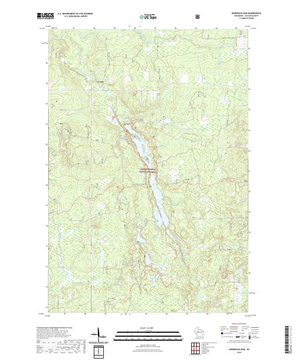 2022 Mondeaux Dam2022 Print · USGSDeep in the Northwoods during the early twenty-first century, this area of Taylor County remains a protected wilderness of the Chequamegon National Forest. You can map out modern hiking routes along the Ice Age National Scenic Trl and identify quiet water features like Glacial Spring and Bullhead Lake.
 - 2022 Map of Medford, 2022 Print
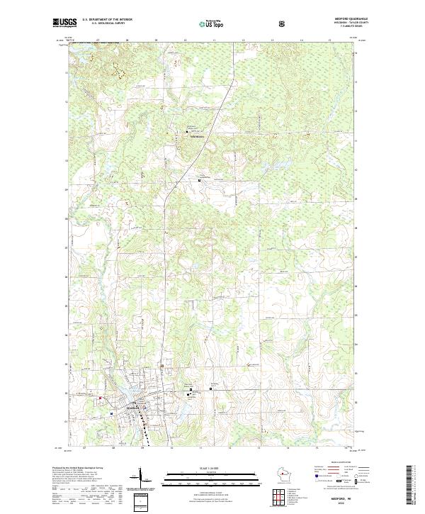 2022 Medford2022 Print · USGSMedford and the surrounding Taylor County dairy and timber lands are captured here in the early twenty-first century. Genealogists can locate family plots at Evergreen Cem I or Whittlesey Catholic Cem, and trace local landmarks like the Taylor County Courthouse.
 - 2022 Map of Medford NW, 2022 Print
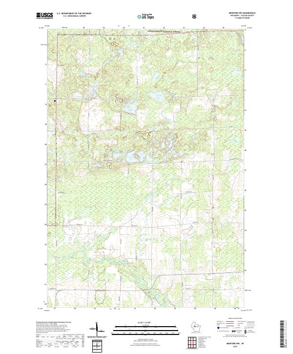 2022 Medford NW2022 Print · USGSTaylor County's lake-rich woodlands appear here during the early twenty-first century, showing a landscape shaped by the Chequamegon National Forest. Researchers can trace local landmarks like Molitor Cem, Schoolhouse Lake, and the winding North Fork Yellow River.
 - 2022 Map of Westboro, 2022 Print
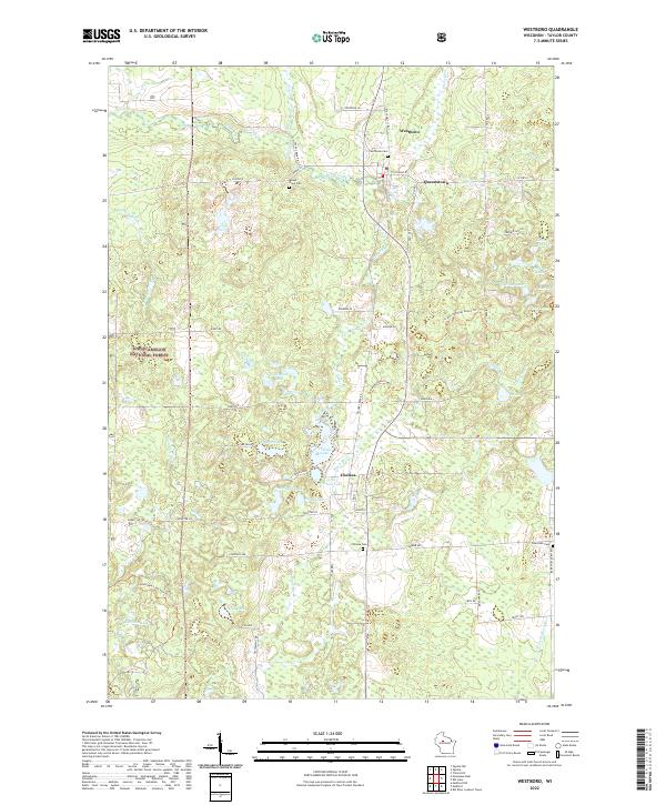 2022 Westboro2022 Print · USGSTaylor County's lake-strewn timberlands are shown here in the early twenty-first century as the Ice Age National Scenic Trl crosses the region. Local historians can trace the areas around Westboro, Chelsea, and Saint Ann Cem amidst the dense Chequamegon National Forest.
End of results
Showing maps 1-4 of 4
Top cities near Chelsea
- Medford historical maps
- Little Black historical maps
- Ogema historical maps
- Rib Lake historical maps
- Westboro historical maps
- Stetsonville historical maps
See more
Top neighborhoods of Chelsea
Frequently asked questions
- What are the different types of historical maps available for Chelsea?
- What is the oldest map of Chelsea?
- Where can I purchase historical maps of Chelsea for my home or office?
- Where can I download high-res historical maps of Chelsea?
- Are there historical topographic maps available for Chelsea?
- Is there historical aerial imagery available for Chelsea?
- Where are historical maps of Chelsea sourced from?