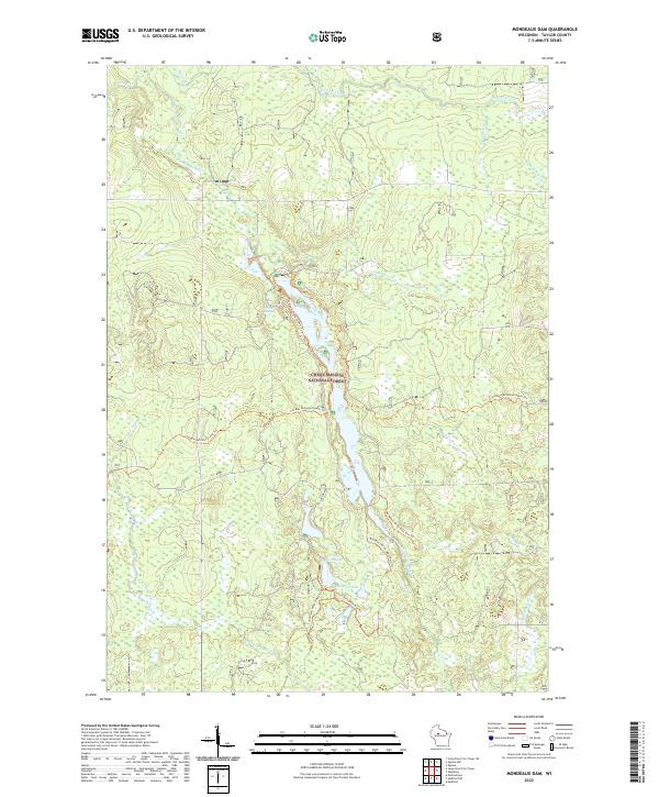
2022 Map of Mondeaux Dam
USGS Topo · Published 2022About this map
Chequamegon National Forest encompasses the entirety of this Taylor County landscape, where the Mondeaux River winds through a complex system of glacial wetlands and water bodies. This 2022 survey illustrates a modern recreational corridor centered on the river's impoundment and the surrounding hills. Hikers and conservationists can trace the long-distance Ice Age National Scenic Trl as it snakes across the terrain, passing through the northern and southern sections of the forest. The map reveals a dense network of water features, from the smaller Camp Eleven Cr and Rocky Run to larger bodies like South Twin Lake and Bullhead Lake. Cultural landmarks such as Glacial Spring and various foot trails including the Mondeaux River West Hwt Trl highlight the area's ongoing importance for public access and environmental preservation.
Find a feature on this map
21 named features on this map. Tap any name to fly to it.
Don’t see what you’re looking for? This feature index may not catch every label — zoom into the map to look around manually.
Map Details
Editions of this 2022 Mondeaux Dam Map
This is the sole edition of this map. No revisions or reprints were ever made.
Other maps of this area

1944 · Ogema
USGS Topo · 1:48,000

1945 · Black River
USGS Topo · 1:48,000

1947 · Ogema
USGS Topo · 1:48,000

1949 · Ogema
USGS Topo · 1:48,000

1949 · Jump River Fire Tower
USGS Topo · 1:48,000

1951 · Lublin
USGS Topo · 1:48,000

1951 · Medford
USGS Topo · 1:48,000

1953 · Rice Lake
USGS Topo · 1:250,000

1959 · Rice Lake
USGS Topo · 1:250,000

1969 · Perkinstown
USGS Topo · 1:24,000