2000s (21st Century) Maps of Goodrich, Wisconsin
Explore 4 historic maps of Goodrich from the 2000s (21st Century). These maps offer a rare glimpse into what life looked like during the 2000s — showing old roads, neighborhoods, homes, and landmarks that have changed or disappeared over time.
Whether you're researching your family's past, planning a metal detecting trip, or studying how Goodrich's landscape evolved across the 2000s, these high-resolution maps are a powerful tool for exploring the history of this region.
- Focus on a specific era: All maps on this page are from the 2000s, giving you a focused view of this time period.
- See what’s changed: Compare century-old streets, trails, and buildings to today's modern landscape using overlays and satellite layers.
- Research with precision: Use these maps for genealogy, historical research, land use analysis, or educational projects.
- View, download, or print: Maps are fully viewable online in high resolution, and can be downloaded or printed for your own records.
Start exploring Goodrich's history through authentic maps from the 2000s. This is your window into the past.
Goodrich, WI maps
(4)- 2022 Map of Athens, 2022 Print
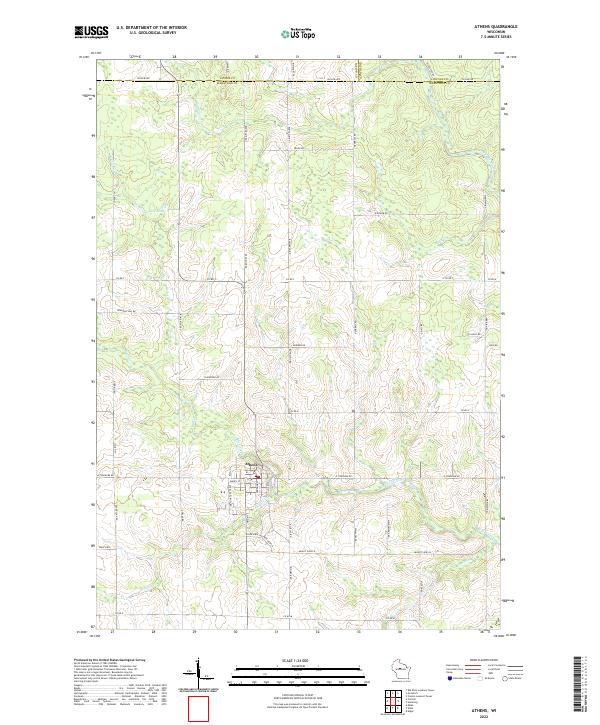 2022 Athens2022 Print · USGSMarathon County agricultural and timber lands surround the village of Athens in this recent survey. Local historians can trace property boundaries along Big Rib River and find landmarks like Lake Allu, Potato Cr, and old rural routes including Lovers Ln.
 - 2022 Map of Goodrich, 2022 Print
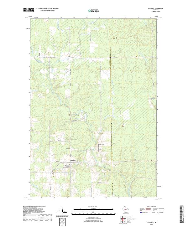 2022 Goodrich2022 Print · USGSThe Taylor County countryside comes into focus in this recent survey, showcasing the rural landscapes along the Big Rib River. Genealogists and local historians can locate the Saint Andrews Evangelical Lutheran Parish Cem and the small communities of Goodrich and Interwald.
 - 2022 Map of Rib River Lookout Tower, 2022 Print
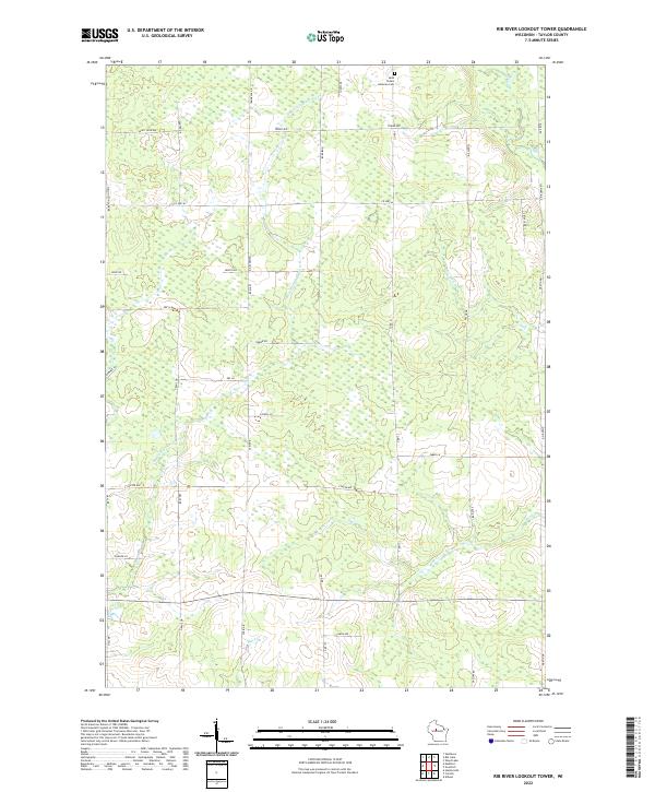 2022 Rib River Lookout Tower2022 Print · USGSTaylor County's rural landscape is documented here in the early twenty-first century, showing a region defined by its small-scale agriculture and forest lands. Researchers can trace local history at Saint Peters Lutheran Cem and follow the paths of E Br Little Black River and Coffee Cr.
 - 2022 Map of Corinth, 2022 Print
 2022 Corinth2022 Print · USGSThe rural borders of Taylor and Marathon Counties come into focus in the early 2020s, showing a landscape defined by generational family farms. Local historians can trace the course of the E Br Big Eau Pleine River and find landmarks like Corinth and Windfall Hill Rd.
End of results
Showing maps 1-4 of 4
Top cities near Goodrich
- Medford historical maps
- Abbotsford historical maps
- Little Black historical maps
- Athens historical maps
- Hamburg historical maps
- Ogema historical maps
See more
Frequently asked questions
- What are the different types of historical maps available for Goodrich?
- What is the oldest map of Goodrich?
- Where can I purchase historical maps of Goodrich for my home or office?
- Where can I download high-res historical maps of Goodrich?
- Are there historical topographic maps available for Goodrich?
- Is there historical aerial imagery available for Goodrich?
- Where are historical maps of Goodrich sourced from?