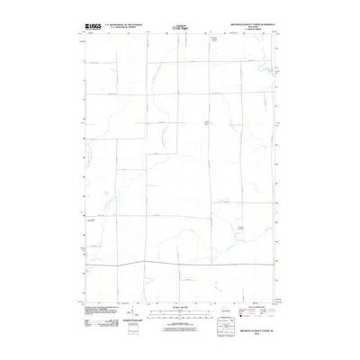
2010 Map of Rib River Lookout Tower
USGS Topo · Published 2010About this map
The Rib River Lookout Tower stands as a prominent geographic landmark in this Taylor County landscape, overlooking a complex network of northern Wisconsin drainage systems. The terrain is defined by the convergence of several waterways, including the Big Rib River in the northeast and the multiple branches of the Little Black River. This 2010 survey illustrates a rural layout dominated by rectangular section lines and local roads such as Tower Ave and County Hwy M, which connect isolated homesteads and small-scale infrastructure. Cultural and historical features are scattered throughout the quadrangle, ranging from the Saint Peters Lutheran Cemetery near the northern boundary to the private Charlies Airport and the Liske H2393 Dam further south. The map reflects a quiet, dispersed settlement pattern where the local economy and geography remain closely tied to the surrounding creeks like Coffee Creek and Mink Creek.
Find a feature on this map
35 named features on this map. Tap any name to fly to it.
Don’t see what you’re looking for? This feature index may not catch every label — zoom into the map to look around manually.
Map Details
Editions of this 2010 Rib River Lookout Tower Map
This is the sole edition of this map. No revisions or reprints were ever made.
Other maps of this area

1902 · Marathon
USGS Topo · 1:125,000

1944 · Ogema
USGS Topo · 1:48,000

1945 · Rib Lake
USGS Topo · 1:48,000

1947 · Rib Lake
USGS Topo · 1:48,000

1947 · Ogema
USGS Topo · 1:48,000

1949 · Ogema
USGS Topo · 1:48,000

1949 · Rib Lake
USGS Topo · 1:48,000

1951 · Athens
USGS Topo · 1:48,000

1951 · Medford
USGS Topo · 1:48,000

1953 · Rice Lake
USGS Topo · 1:250,000