2000s (21st Century) Maps of Molitor, Wisconsin
Explore 8 historic maps of Molitor from the 2000s (21st Century). These maps offer a rare glimpse into what life looked like during the 2000s — showing old roads, neighborhoods, homes, and landmarks that have changed or disappeared over time.
Whether you're researching your family's past, planning a metal detecting trip, or studying how Molitor's landscape evolved across the 2000s, these high-resolution maps are a powerful tool for exploring the history of this region.
- Focus on a specific era: All maps on this page are from the 2000s, giving you a focused view of this time period.
- See what’s changed: Compare century-old streets, trails, and buildings to today's modern landscape using overlays and satellite layers.
- Research with precision: Use these maps for genealogy, historical research, land use analysis, or educational projects.
- View, download, or print: Maps are fully viewable online in high resolution, and can be downloaded or printed for your own records.
Start exploring Molitor's history through authentic maps from the 2000s. This is your window into the past.
Molitor, WI maps
(8)- 2005 Map of Mondeaux Dam, 2006 Print
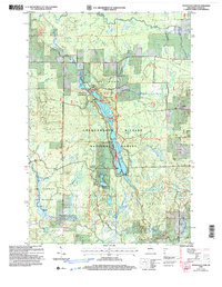 2005 Mondeaux Dam2006 Print · USGSNorthern Wisconsin's glacial forest landscape is captured here in the early 2000s, centered on the Mondeaux Flowage. Trace the path of the National Scenic Trail past recreation sites like Spearhead and Picnic Point.
 - 2005 Map of Jump River Fire Tower, 2006 Print
 2005 Jump River Fire Tower2006 Print · USGSTaylor County forest lands are captured here in the early 2000s, showing a landscape defined by conservation and glacial history. Trace the remote trails of the Ice Age Semi Primitive Non Motorized Area or locate the Jump River Fire Tower and Lost Lake.
 - 2005 Map of Perkinstown, 2006 Print
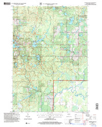 2005 Perkinstown2006 Print · USGSThe Taylor County woods and wetlands are captured here just after the turn of the millennium, showing the intricate landscape of the Chequamegon Nicolet National Forest. Researchers can locate family roots at the Perkinstown Cem or trace the winding path of the Ice Age Interpretative Trail.
 - 2005 Map of Medford NW, 2006 Print
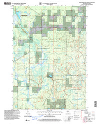
 2005 Medford NW2006 Print · USGSNorthwestern Taylor County is shown here in the mid-2000s, where the national forest meets the agricultural headwaters of the Black River. Genealogists can locate family landmarks like the Molitor Cem, Brookside Sch, and the Townhall.
 - 2022 Map of Jump River Fire Tower, 2022 Print
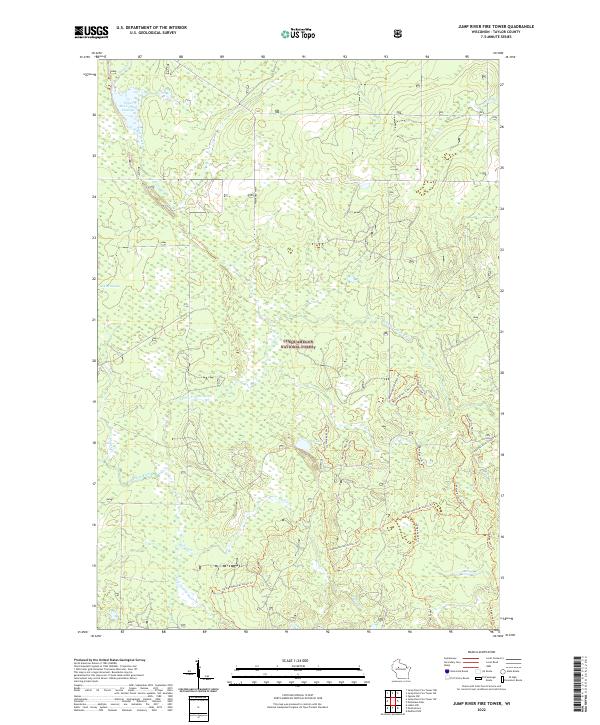 2022 Jump River Fire Tower2022 Print · USGSTaylor County's managed woodlands are shown here in the early twenty-first century as part of the massive Chequamegon National Forest. Hikers and researchers can trace the winding Ice Age National Scenic Trl or locate water features like Upper Steve Creek Flowage and East Lake.
 - 2022 Map of Perkinstown, 2022 Print
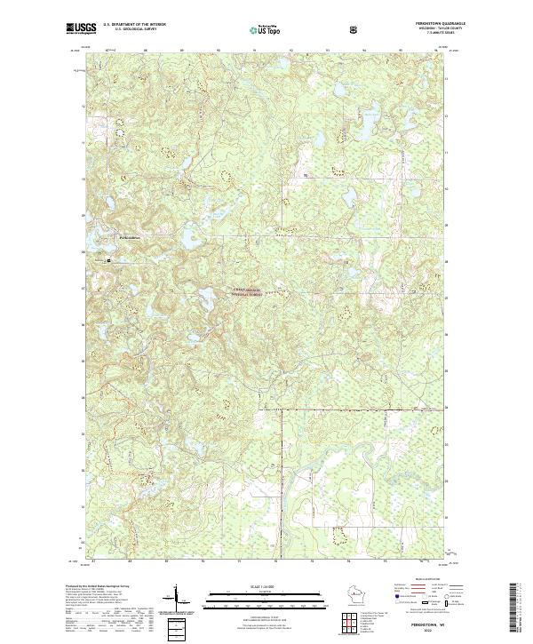 2022 Perkinstown2022 Print · USGSTaylor County’s densely wooded lake country is captured here in the early twenty-first century, centered on the historic settlement of Perkinstown. Outdoor enthusiasts and researchers can trace the Ice Age National Scenic Trail as it snakes past Lake Nineteen and Nancy Lake through the Chequamegon National Forest.
 - 2022 Map of Mondeaux Dam, 2022 Print
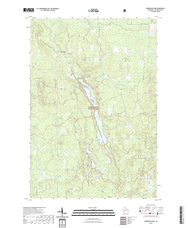 2022 Mondeaux Dam2022 Print · USGSDeep in the Northwoods during the early twenty-first century, this area of Taylor County remains a protected wilderness of the Chequamegon National Forest. You can map out modern hiking routes along the Ice Age National Scenic Trl and identify quiet water features like Glacial Spring and Bullhead Lake.
 - 2022 Map of Medford NW, 2022 Print
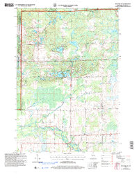
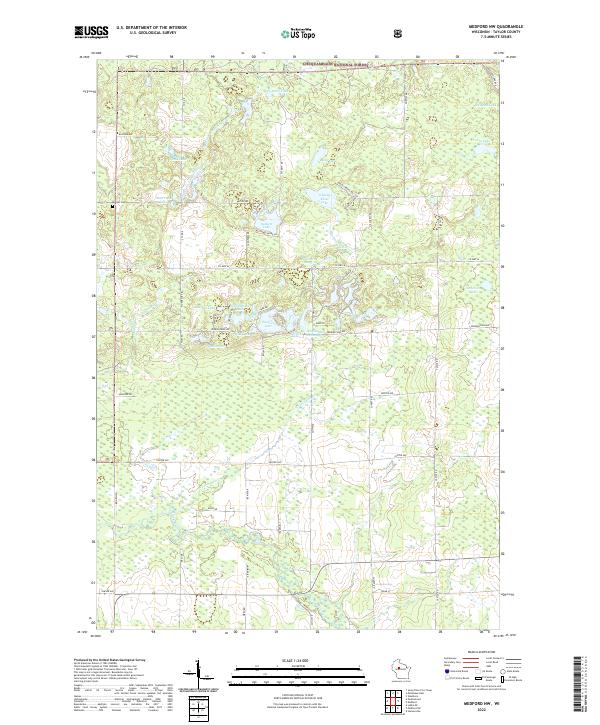 2022 Medford NW2022 Print · USGSTaylor County's lake-rich woodlands appear here during the early twenty-first century, showing a landscape shaped by the Chequamegon National Forest. Researchers can trace local landmarks like Molitor Cem, Schoolhouse Lake, and the winding North Fork Yellow River.
End of results
Showing maps 1-8 of 8
Top cities near Molitor
- Medford historical maps
- Little Black historical maps
- Ogema historical maps
- Chelsea historical maps
- Westboro historical maps
- Stetsonville historical maps
See more
Frequently asked questions
- What are the different types of historical maps available for Molitor?
- What is the oldest map of Molitor?
- Where can I purchase historical maps of Molitor for my home or office?
- Where can I download high-res historical maps of Molitor?
- Are there historical topographic maps available for Molitor?
- Is there historical aerial imagery available for Molitor?
- Where are historical maps of Molitor sourced from?