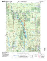
2005 Map of Mondeaux Dam
USGS Topo · Published 2006About this map
The Mondeaux Flowage serves as the centerpiece of this northern landscape, winding through the Chequamegon-Nicolet National Forest south of Westboro. This 2005 revision reflects a region dedicated to conservation and low-impact recreation, notably featuring the Ice Age Semi Primitive Non Motorized Area and the National Scenic Trail which meanders through the glacial terrain. The Mondeaux Dam Recreation Area anchors the northern end of the flowage, supported by several named campsites and access points like Lakeview, Eastwood, and Picnic Point. Beyond the central waterway, the map details the transition between the Mondeaux River and the Yellow River basins, interspersed with smaller water bodies such as North Twin Lake and South Twin Lake. This sheet provides a clear view of the forest's management zones, including sections like Molitor and Chelsea.
Find a feature on this map
29 named features on this map. Tap any name to fly to it.
Don’t see what you’re looking for? This feature index may not catch every label — zoom into the map to look around manually.
Map Details
Editions of this 2005 Mondeaux Dam Map
This is the sole edition of this map. No revisions or reprints were ever made.
Other maps of this area

1944 · Ogema
USGS Topo · 1:48,000

1945 · Black River
USGS Topo · 1:48,000

1947 · Ogema
USGS Topo · 1:48,000

1949 · Ogema
USGS Topo · 1:48,000

1949 · Jump River Fire Tower
USGS Topo · 1:48,000

1951 · Lublin
USGS Topo · 1:48,000

1951 · Medford
USGS Topo · 1:48,000

1953 · Rice Lake
USGS Topo · 1:250,000

1959 · Rice Lake
USGS Topo · 1:250,000

1969 · Perkinstown
USGS Topo · 1:24,000