Old Maps of Chimney Rock, Wisconsin for Academic Research
Study the evolution of Chimney Rock with 19 high-resolution historic maps. Whether you're teaching, researching, or modeling changes in land use, these maps provide essential visual documentation of urban, environmental, and geographic change.
- Analyze long-term change: Track patterns in development, transportation, and natural features.
- Ideal for environmental or urban studies: Support academic projects with primary historical map data.
- Use in the classroom or lab: Educators and researchers rely on these maps to bring historical context to life.
These maps are a powerful tool for teaching, research, and visualizing how Chimney Rock has changed over the decades.
Chimney Rock, WI maps
(19)- 1926 Map of Whitehall, 1972 Print
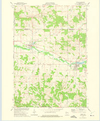
 1926 Whitehall1972 Print · USGSTrempealeau County is captured here in the mid-twenties, a landscape of coulees and river valleys shaped by the Green Bay and Western Railroad. Genealogists can locate dozens of country schools and homestead-named landmarks like Chimney Rock or the Trempealeau County Asylum.
 - 1927 Map of Strum, 1972 Print
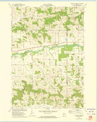
 1927 Strum1972 Print · USGSWisconsin's coulee country in the late 1920s is captured here, showing the river-and-rail economies of the Buffalo River valley. Genealogists can locate dozens of country schoolhouses like Hale Corner Sch and family-named landmarks such as Hadleyville Cem.
 - 1929 Map of Whitehall
 1929 Whitehall1929 Print · USGSTrempealeau County during the late twenties is shown here as a dense network of coulees and river-bottom settlements. Researchers can trace early railroad history along the Green Bay and Western RR and locate many rural landmarks including the County Asylum and Brookside Sch.2 unique versions available
 - 1930 Map of Strum
 1930 Strum1930 Print · USGSWestern Wisconsin's river valleys and rail corridors are captured here just before the 1930s. Researchers can trace the lineage of rural townships like Washington and Unity through a network of country schools and churches, including St Paul Ch and Big Creek Sch.2 unique versions available
 - 1932 Map of Gilmanton
 1932 Gilmanton1932 Print · USGSBuffalo and Trempealeau Counties appear here in the early thirties, showing a rural landscape organized around deep valleys and high ridges. Genealogists can locate dozens of family-named landmarks and country schools like Lookout Sch and the Irish Valley Sch.2 unique versions available
 - 1932 Map of Mondovi
 1932 Mondovi1932 Print · USGSThe Buffalo River valley and surrounding coulees are shown here in the early thirties, centered on the hub of Mondovi. Genealogists can locate dozens of country schoolhouses like White Block Sch and rural landmarks such as Norden Ch.2 unique versions available
 - 1953 Map of Eau Claire, 1965 Print
 1953 Eau Claire1965 Print · USGSWest-central Wisconsin in the mid-fifties shows a landscape of river-valley industry and vast wildlife refuges during the transition from rails to modern highways. Genealogists and historians can trace the rail corridors of the Chicago and North Western or locate family-named landmarks like Decorah Mound and Chippewa Island.4 unique versions available
 - 1958 Map of Eau Claire
 1958 Eau Claire1958 Print · USGSWestern Wisconsin in the late fifties shows a landscape of growing regional hubs and massive wildlife refuges. Trace the rail lines of the Chicago and North Western between Eau Claire and Marshfield, or explore the terrain around Iron Mound and Lake Wissota.
 - 1964 Map of Eau Claire
 1964 Eau Claire1964 Print · USGSWest-central Wisconsin in the mid-1960s was a hub of river-driven industry and expanding rail networks. Researchers can trace historic homesteads near Menomonie, follow the Soo Line RR through Marshfield, or explore the grounds of the Camp McCoy Military Reservation.
 - 1973 Map of Strum, 1975 Print
 1973 Strum1975 Print · USGSTrempealeau County farm and rail life are centered here in the early seventies, as the river valley connects active village centers. Genealogists and historians can trace local landmarks like Hamlin Cem, the Central Area High Sch, and the winding Chicago and North Western rail line.
 - 1973 Map of Elk Creek, 1975 Print
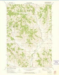 1973 Elk Creek1975 Print · USGSTrempealeau County's rural coulee country is captured in the early seventies, showing a landscape defined by deep valleys and high ridges. Researchers can locate family-named landmarks like Walek Knob and burial sites such as Chimney Rock Cem and Cripps Cem.
 - 1973 Map of Rossman Creek, 1975 Print
 1973 Rossman Creek1975 Print · USGSBuffalo County's rugged coulee country is captured here in the early 1970s as the rail-and-river economy persists along the Buffalo River. Genealogists and local historians can locate the Norden Trinity Ch, the Naples Sch, and family-named terrain like Lindsay Valley.
 - 1973 Map of Lookout, 1975 Print
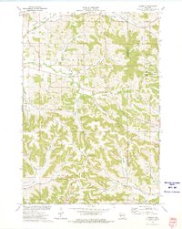 1973 Lookout1975 Print · USGSBuffalo County in the early seventies is a landscape of tight-knit valley communities and high ridges. Genealogists and local historians can trace rural family roots through numerous sites like Lookout Cemetery, Severson Cem, and the prominent Montana Ridge.
 - 1985 Map of Eau Claire
 1985 Eau Claire1985 Print · USGSWestern Wisconsin's river valleys and growing mid-century cities are captured here in the mid-eighties. Genealogists and historians can trace the paths of the Chicago and North Western railroad and locate rural landmarks like Dells Millpond and Nine Mile Island.2 unique versions available
 - 1985 Map of Winona
 1985 Winona1985 Print · USGSThe Mississippi River valley and the coulees of the Driftless Area are shown here in the mid-1980s as the river's lock-and-dam system was well-established. Researchers can trace the riverfront at Winona, explore the bluffs near Galesville, or locate landmarks like Sugarloaf and Merrick State Park.2 unique versions available
 - 2022 Map of Elk Creek, 2022 Print
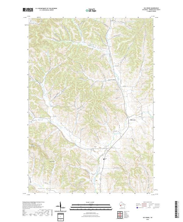 2022 Elk Creek2022 Print · USGSTrempealeau County's rural coulee country remains centered around the small community of Elk Creek in this modern survey. Genealogists and local historians can trace family-named landmarks like Walek Knob and find the location of the Cripps Cem.
 - 2022 Map of Rossman Creek, 2022 Print
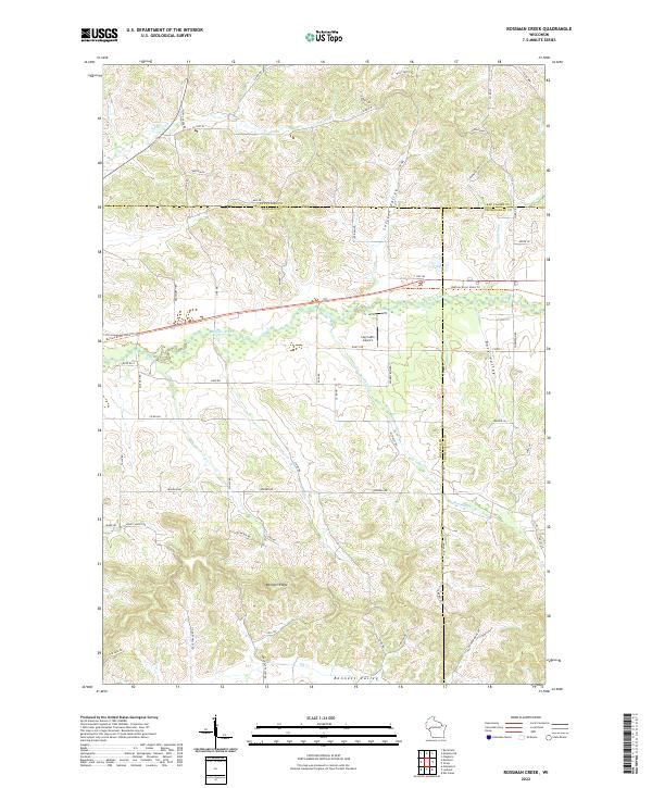 2022 Rossman Creek2022 Print · USGSBuffalo County and the surrounding tri-county area are shown in this modern survey of the Driftless-style terrain. Researchers can trace the winding Buffalo River corridor and locate local landmarks like the Log Cabin Airport and Bennett Ridge.
 - 2022 Map of Strum, 2022 Print
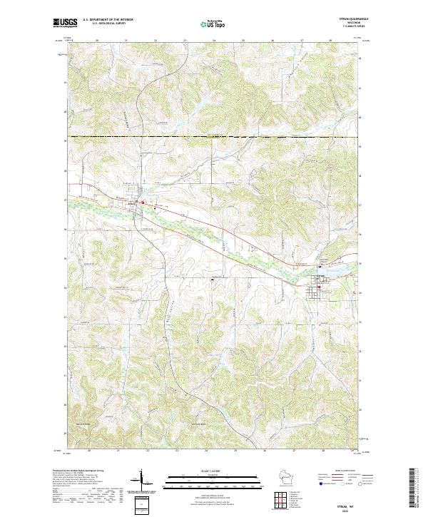 2022 Strum2022 Print · USGSThe Buffalo River valley comes into focus in this contemporary survey of Trempealeau and Eau Claire counties. Researchers can trace landownership patterns through family-named landmarks like Bennett Ridge and Anderson Valley or locate local burials at Hamlin Cem.
 - 2022 Map of Lookout, 2022 Print
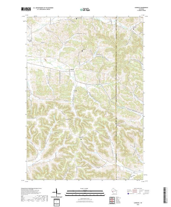 2022 Lookout2022 Print · USGSThe Buffalo and Trempealeau county border comes alive in this contemporary survey of its characteristic ridge-and-valley terrain. Researchers can trace family history through several rural cemeteries like Julson Cem and the namesake settlement of Lookout.
End of results
Showing maps 1-19 of 19
Top cities near Chimney Rock
- Arcadia historical maps
- Pleasant Valley historical maps
- Mondovi historical maps
- Whitehall historical maps
- Independence historical maps
- Strum historical maps
See more
Top neighborhoods of Chimney Rock
Frequently asked questions
- What are the different types of historical maps available for Chimney Rock?
- What is the oldest map of Chimney Rock?
- Where can I purchase historical maps of Chimney Rock for my home or office?
- Where can I download high-res historical maps of Chimney Rock?
- Are there historical topographic maps available for Chimney Rock?
- Is there historical aerial imagery available for Chimney Rock?
- Where are historical maps of Chimney Rock sourced from?