Old Maps of Lac du Flambeau, Wisconsin for Metal Detecting
Plan your next treasure hunt with 54 historic maps of Lac du Flambeau. Find old homesites, ghost towns, trails, and gathering spots that may be lost to time — perfect for identifying promising metal detecting locations.
- Locate forgotten sites: Uncover places like long-lost settlements, abandoned rail lines, or gathering spots.
- Plan better hunts: Use map overlays combined with LiDAR or satellite views to narrow in on historically rich areas.
- Made for detectorists: Thousands of hobbyists use these maps to discover relics, coins, and hidden history.
Use these historic maps to boost your research and find new opportunities beneath the surface of Lac du Flambeau.
Lac du Flambeau, WI maps
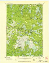
(54)- 1938 Map of Lac Du Flambeau, 1959 Print
 1938 Lac Du Flambeau1959 Print · USGSThe Wisconsin lake district appears in detail during the late 1930s, showing the early infrastructure of the northern woods. Researchers can trace the Chicago and Northwestern rail line and locate community landmarks like Marlands Sch and the Flambeau Fire Tower.2 unique versions available
 - 1939 Map of Lac Du Flambeau
 1939 Lac Du Flambeau1939 Print · USGSWisconsin's lake country is captured here in the late thirties, documenting a landscape defined by the intersection of tribal lands and national forests. Genealogists and historians can trace the early rail stops and rural schoolhouses like Marlands Sch, Hasener, and the Lac du Flambeau Sta.
 - 1939 Map of Winchester
 1939 Winchester1939 Print · USGSWisconsin's lake-strewn Northwoods are documented here in the late thirties as the region transitioned into a destination for conservation and recreation. Researchers can locate Depression-era infrastructure like the CCC Camp or trace family roots near Winchester, Spider Lake Sch, and Powell.2 unique versions available
 - 1941 Map of Pike Lake, 1952 Print
 1941 Pike Lake1952 Print · USGSPrice County timberland and lake country are captured here at the end of the 1930s as the river-and-rail economy transitioned toward forest management. Genealogists and historians can locate the Riley Creek CCC Camp, the Shady Knoll Sch, and landmarks like the South Fork Fire Tower.3 unique versions available
 - 1942 Map of Pike Lake
 1942 Pike Lake1942 Print · USGSPrice County and the surrounding lake country are documented here in the early 1940s, showing a landscape shaped by timber and early recreation. Researchers can trace the Riley Creek CCC Camp, the Shady Knoll Sch, and landmarks like the South Fork Fire Tower.
 - 1946 Map of Winchester
 1946 Winchester1946 Print · USGSNorthern Wisconsin's lake country was a landscape of remote settlements and timber management during the mid-forties. Genealogists and local historians can trace the footprint of early communities at Winchester and Presque Isle, or locate the Winegar Church and the regional CCC Camp.
 - 1946 Map of Lac Du Flambeau
 1946 Lac Du Flambeau1946 Print · USGSOneida and Vilas counties are seen here in the mid-1940s, a time when the lake country was defined by timber management and rail access. Genealogists can locate the Marlands Sch and Lac du Flambeau Sta along the Chicago and Northwestern line.
 - 1950 Map of Pike Lake
 1950 Pike Lake1950 Print · USGSNorthern Wisconsin's timber and lake country comes to life in the mid-century, showing a landscape shaped by conservation and seasonal recreation. Local historians can trace the locations of the Riley Creek CCC Camp, Shady Knoll Sch, and numerous family-named landmarks like Patterson Lake.
 - 1950 Map of Lac Du Flambeau
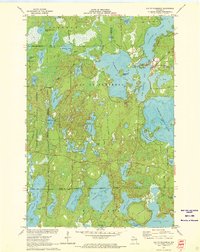
 1950 Lac Du Flambeau1950 Print · USGSThe northern lake country of Vilas and Oneida Counties is captured here at mid-century, centered on the Lac du Flambeau reservation. Researchers can trace the old Chicago and Northwestern rail line and locate landmarks like the Marlands Sch or the Flambeau Fire Tower.
 - 1951 Map of Lac Du Flambeau
 1951 Lac Du Flambeau1951 Print · USGSNorthern Wisconsin's lake country is captured here during the mid-century, showing the established communities of the Flambeau area. Genealogists and local historians can trace the Chicago and Northwestern rail line and find sites like Marlands Sch or the Flambeau Fire Tower.
 - 1953 Map of Rice Lake, 1967 Print
 1953 Rice Lake1967 Print · USGSNorthwest Wisconsin during the mid-fifties reveals a landscape defined by timber, rail, and water. Genealogists and historians can trace the development of river towns like Ladysmith and Rice Lake along the Soo Line and Chicago and North Western railroads.2 unique versions available
 - 1954 Map of Iron Mountain, 1964 Print
 1954 Iron Mountain1964 Print · USGSUpper Michigan and Northeastern Wisconsin are shown in detail during the mid-fifties, when the logging and mining economies still moved by rail. Trace the rail lines of the Soo Line to remote stops like Koepenick Station or explore the Iron Range near Iron Mountain.2 unique versions available
 - 1955 Map of Winchester, 1957 Print
 1955 Winchester1957 Print · USGSVilas County's lake country is captured here during the mid-fifties, showing the intersection of state forest lands and tribal geography. Trace the old rail lines of the Chicago and Northwestern or locate landmarks like Birch Lake Sch and the Cranberry Bogs.4 unique versions available
 - 1958 Map of Iron River, 1968 Print
 1958 Iron River1968 Print · USGSThe Upper Peninsula in the late fifties is captured here as a landscape of timber, iron, and rail. Genealogists and historians can trace rail stops like Mass Station or explore the coastlines of Lake Gogebic and Keweenaw Bay.3 unique versions available
 - 1959 Map of Rice Lake
 1959 Rice Lake1959 Print · USGSNorthwest Wisconsin in the late fifties was a land of expanding road networks and deep-seated timber history. Genealogists and historians can trace rail lines like the Soo Line RR and Chicago St Paul Minneapolis and Omaha Ry as they link settlements from Spooner to Medford.
 - 1959 Map of Iron Mountain
 1959 Iron Mountain1959 Print · USGSThe northwoods of Wisconsin and the Michigan border are captured here in the mid-fifties, showing a landscape defined by timber, water, and rail. Researchers can trace historic junctions like Hiles Junction, the expansive Nicolet National Forest, and lakefront settlements from Rhinelander to Tomahawk.2 unique versions available
 - 1960 Map of Iron River
 1960 Iron River1960 Print · USGSThe Upper Peninsula’s western reaches are shown in the late fifties, featuring the industrial infrastructure of the Copper Country and the vast Ottawa National Forest. Researchers can trace the rail lines of the Milwaukee Road through settlements like Bruce Crossing and the White Pine Mine.
 - 1961 Map of Iron River
 1961 Iron River1961 Print · USGSThe Upper Peninsula and northern Wisconsin are shown here in the early 1960s, a landscape defined by the iron range and vast timberlands. Researchers can trace the legacy of mining and rail transport through Caspian, the Lac Du Flambeau Indian Reservation, and the Milwaukee Road.
 - 1967 Map of Iron River, 1968 Print
 1967 Iron River1968 Print · USGSThe Upper Peninsula and northern Wisconsin borderlands are shown here in the late sixties, a landscape of deep woods and iron-country rail lines. Genealogists and historians can trace the lakeside settlements of L'Anse and Ontonagon or follow the Soo Line through towns like Michigamme and Nestoria.
 - 1971 Map of Pike Lake, 1973 Print
 1971 Pike Lake1973 Print · USGSIn the early 1970s, the lake country at the junction of Price, Iron, and Vilas counties was a landscape of deep forests and interconnected waterways. Researchers can trace the Chippewa Trail, locate the Lookout Tower on Sentinel Point, and explore the shorelines of Round Lake and Pike Lake.
 - 1971 Map of Lac Du Flambeau, 1973 Print
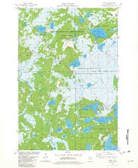
 1971 Lac Du Flambeau1973 Print · USGSLac du Flambeau and its surrounding lakes are captured here in the early seventies, showing a landscape defined by water and forest. Researchers can trace the Reservation Boundary and find local landmarks like the Indian Agency and Strawberry Island.3 unique versions available
 - 1971 Map of Fence Lake, 1973 Print
 1971 Fence Lake1973 Print · USGSThe Vilas County lake country is captured here in the early 1970s, during a time of significant recreational growth within the Lac du Flambeau Indian Reservation. Researchers can trace the Chicago and North Western rail line past Marlands or locate landmarks like the Flambeau Lookout Tower.
 - 1980 Map of Park Falls
 1980 Park Falls1980 Print · USGSNorthern Wisconsin's timber and rail corridor is meticulously detailed here in the early eighties. Researchers can trace the Soo Line through forest-bound towns like Park Falls, Phillips, and Lugerville while exploring the vast Chequamegon National Forest.
 - 1981 Map of Manitowish Lake, 1982 Print
 1981 Manitowish Lake1982 Print · USGSVilas County's lake-country character is preserved in this early 1980s record of a storied Wisconsin vacation and conservation district. Researchers can locate legacy camps like Camp Nawakwa, local landmarks such as Pine Lawn Cem, and the massive Cranberry Bogs.
 - 1981 Map of Powell, 1982 Print
 1981 Powell1982 Print · USGSIron and Vilas counties are seen here in the early 1980s, where the Northwoods landscape is shaped by the Chicago and North Western railroad. Trace the small settlements of Powell and Powell No 2 alongside the sprawling Powell Marsh State Public Hunting Grounds.
Showing maps 1-25 of 54
Top cities near Lac du Flambeau
- Minocqua historical maps
- Mercer historical maps
- Hazelhurst historical maps
- Boulder Junction historical maps
- Fifield historical maps
- Woodruff historical maps
See more
Top neighborhoods of Lac du Flambeau
Frequently asked questions
- What are the different types of historical maps available for Lac du Flambeau?
- What is the oldest map of Lac du Flambeau?
- Where can I purchase historical maps of Lac du Flambeau for my home or office?
- Where can I download high-res historical maps of Lac du Flambeau?
- Are there historical topographic maps available for Lac du Flambeau?
- Is there historical aerial imagery available for Lac du Flambeau?
- Where are historical maps of Lac du Flambeau sourced from?