Old Maps of Plum Lake, Wisconsin for Hiking & Exploration
Hike through history with 34 historic maps of Plum Lake. Explore old trails, ghost towns, and forgotten backroads — perfect for outdoor adventurers and local explorers.
- Rediscover forgotten places: Map out old mining camps, roads, and footpaths that no longer exist on modern maps.
- Layer with modern tools: Combine with LiDAR or satellite views to plan hikes through historical terrain.
- Made for exploration: Popular among hikers, overlanders, and local history lovers.
Use these maps to find adventure and explore the hidden past of Plum Lake.
Plum Lake, WI maps
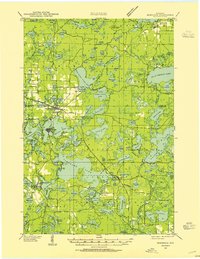
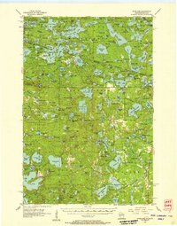
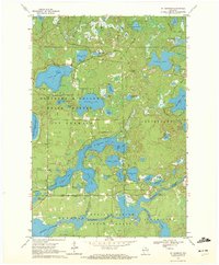
(34)- 1930 Map of Robbins
 1930 Robbins1930 Print · USGSThe Vilas and Oneida County lake country comes into focus in the early 1930s as tourism and industry overlap. Locate vanished rural schoolhouses like Evergreen Sch. and Sebastian Sch. or trace the early path of the Chicago and Northwestern RR.2 unique versions available
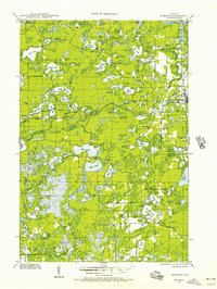
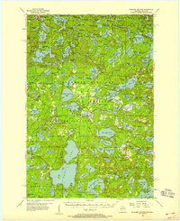
 - 1938 Map of Minocqua, 1955 Print
 1938 Minocqua1955 Print · USGSOneida and Vilas Counties are shown as a thriving Northwoods destination in the late thirties, when rail lines still delivered visitors to the lakefronts. Trace the footprints of local life at Hall Sch, Evergreen Cem, and the Muskellunge Fire Tower.2 unique versions available
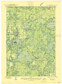
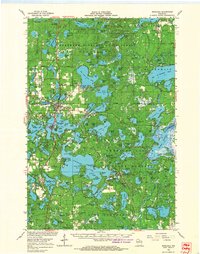
 - 1938 Map of Robbins, 1957 Print
 1938 Robbins1957 Print · USGSNorthern Wisconsin’s lake country was a mosaic of rural school districts and new hydroelectric power in the late 1930s. Genealogists can locate family-named landmarks like Kuehn Sch and Bohemian Sch or trace the early Rhinelander Trail.2 unique versions available
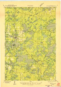
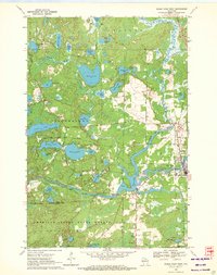
 - 1939 Map of Trout Lake
 1939 Trout Lake1939 Print · USGSNorthern Wisconsin's lake country is captured here in the late thirties as the region transitioned into a premier outdoor destination. Trace the development of Boulder Junction, the locations of a CCC Camp, and fire suppression lookouts like the Boulder Fire Tower.
 - 1945 Map of Robbins, 1946 Print
 1945 Robbins1946 Print · USGSWisconsin's Northwoods come alive in this mid-century survey of the lake country around the Vilas and Oneida county line. Genealogists can trace family footprints through numerous rural schoolhouses like Lake Kathan Sch and forgotten sites like Wakefield and Robbins.
 - 1946 Map of Star Lake
 1946 Star Lake1946 Print · USGSVilas County was a landscape of deep woods and glacial lakes in the late thirties as the timber era gave way to early tourism. Genealogists and historians can trace the Chicago and Northwestern Line rail corridor and find early landmarks like the Monahan Fire Tower and Star Lake settlement.
 - 1946 Map of Minocqua
 1946 Minocqua1946 Print · USGSThe Wisconsin Northwoods thrive in the mid-1940s, showing a landscape of glacial lakes and bustling rail-connected resort towns. Genealogists and local historians can trace rural institutions like Faulkner Sch, the State Fish Hatchery, and the Evergreen Ch.
 - 1946 Map of Trout Lake
 1946 Trout Lake1946 Print · USGSVilas County and the Michigan border are captured here during the late 1930s, showcasing a landscape of dense lakes and early forest management. Local historians can trace the development of Boulder Junction, the presence of a CCC Camp, and the historic State Forest Headquarters.
 - 1949 Map of Trout Lake
 1949 Trout Lake1949 Print · USGSThe Vilas County lake country is captured here during the post-war years, showcasing a dense network of waterways and early conservation sites. Researchers can locate the CCC Camp, the settlement of Boulder Junction, and the Boulder Fire Tower.
 - 1949 Map of Minocqua
 1949 Minocqua1949 Print · USGSThe heart of the Wisconsin Northwoods is captured here at mid-century, defined by a dense tapestry of lakes and early railroad corridors. Genealogists and historians can trace family-named schools and early lakeside settlements like Arbor Vitae, Sayner, and Hazelhurst.
 - 1950 Map of Star Lake
 1950 Star Lake1950 Print · USGSVilas County's lake-strewn borderlands are captured here at mid-century, showing a landscape defined by timber management and early rail travel. Researchers can trace the Chicago and Northwestern Ry through Conover and locate remote outposts like Camp 5 or the Monahan Fire Tower.
 - 1954 Map of Iron Mountain, 1964 Print
 1954 Iron Mountain1964 Print · USGSUpper Michigan and Northeastern Wisconsin are shown in detail during the mid-fifties, when the logging and mining economies still moved by rail. Trace the rail lines of the Soo Line to remote stops like Koepenick Station or explore the Iron Range near Iron Mountain.2 unique versions available
 - 1955 Map of Starlake, 1957 Print
 1955 Starlake1957 Print · USGSThe Wisconsin-Michigan border country is shown here in the mid-fifties, dominated by the dense waters of the Northwoods. Researchers can trace the Chicago and North Western line or locate local landmarks like Covenant Ch and Starlake.4 unique versions available
 - 1955 Map of Boulder Junction, 1957 Print
 1955 Boulder Junction1957 Print · USGSThe Northwoods of Vilas County are captured here in the mid-fifties, showing the lake-heavy terrain of Boulder Junction and Arbor Vitae. Researchers can trace old lakeside sites like the Boy Scout Camp, the Lookout Tower, and the local Notre Dame Church.5 unique versions available
 - 1958 Map of Iron River, 1968 Print
 1958 Iron River1968 Print · USGSThe Upper Peninsula in the late fifties is captured here as a landscape of timber, iron, and rail. Genealogists and historians can trace rail stops like Mass Station or explore the coastlines of Lake Gogebic and Keweenaw Bay.3 unique versions available
 - 1959 Map of Iron Mountain
 1959 Iron Mountain1959 Print · USGSThe northwoods of Wisconsin and the Michigan border are captured here in the mid-fifties, showing a landscape defined by timber, water, and rail. Researchers can trace historic junctions like Hiles Junction, the expansive Nicolet National Forest, and lakefront settlements from Rhinelander to Tomahawk.2 unique versions available
 - 1960 Map of Iron River
 1960 Iron River1960 Print · USGSThe Upper Peninsula’s western reaches are shown in the late fifties, featuring the industrial infrastructure of the Copper Country and the vast Ottawa National Forest. Researchers can trace the rail lines of the Milwaukee Road through settlements like Bruce Crossing and the White Pine Mine.
 - 1961 Map of Iron River
 1961 Iron River1961 Print · USGSThe Upper Peninsula and northern Wisconsin are shown here in the early 1960s, a landscape defined by the iron range and vast timberlands. Researchers can trace the legacy of mining and rail transport through Caspian, the Lac Du Flambeau Indian Reservation, and the Milwaukee Road.
 - 1966 Map of Minocqua, 1968 Print
 1966 Minocqua1968 Print · USGSThe Northwoods of Wisconsin are shown in the mid-1960s, documenting a premier lake-resort region centered on Minocqua and Woodruff. Researchers can trace old rail lines like the MILWAUKEE ROAD, explore family-named landmarks like Olmstead Island, or find vanished local sites such as the Drive-in Theater.2 unique versions available
 - 1967 Map of Iron River, 1968 Print
 1967 Iron River1968 Print · USGSThe Upper Peninsula and northern Wisconsin borderlands are shown here in the late sixties, a landscape of deep woods and iron-country rail lines. Genealogists and historians can trace the lakeside settlements of L'Anse and Ontonagon or follow the Soo Line through towns like Michigamme and Nestoria.
 - 1970 Map of Eagle River West, 1972 Print
 1970 Eagle River West1972 Print · USGSVilas and Oneida Counties appear here as a interconnected network of Northwoods lakes and timberlands during the early 1970s. Trace the industrial and civic landscape through the Chicago and North Western rail line, the Otter Rapids Dam, and the Fairground.2 unique versions available
 - 1970 Map of St. Germain, 1972 Print
 1970 St. Germain1972 Print · USGSVilas and Oneida counties are captured here in the 1970s, a landscape defined by its glacial lakes and the expansive timberlands of the state forest. Genealogists and local historians can locate the St Germain Cem and trace the original paths of Birchwood Drive and Juve Road.3 unique versions available
 - 1981 Map of White Sand Lake, 1982 Print
 1981 White Sand Lake1982 Print · USGSVilas County's lake country is captured here in the early eighties, showcasing a landscape defined by water and woods. Trace the recreation history of the state forest through sites like Camp Osoma, Big Muskellunge Lake, and Crystal Lake.
 - 1982 Map of Star Lake
 1982 Star Lake1982 Print · USGSVilas County's lake country is captured here in the early eighties, centered on the settlement of Star Lake and the surrounding state forest. Researchers can trace the legacy of early industry and local landmarks, from the Old Grade and Gravel Pit to the Indian Cem and Monahan Lookout Tower.
 - 1982 Map of Stormy Lake
 1982 Stormy Lake1982 Print · USGSNorthern Wisconsin lake country is captured here in the early eighties, centered on the settlement of Conover. Trace the Chicago and North Western line past the waters of Stormy Lake and the Upper Buckatabon Lake shoreline.
Showing maps 1-25 of 34
Top cities near Plum Lake
- Minocqua historical maps
- Newbold historical maps
- Sugar Camp historical maps
- Eagle River historical maps
- Conover historical maps
- Boulder Junction historical maps
See more
Top neighborhoods of Plum Lake
Frequently asked questions
- What are the different types of historical maps available for Plum Lake?
- What is the oldest map of Plum Lake?
- Where can I purchase historical maps of Plum Lake for my home or office?
- Where can I download high-res historical maps of Plum Lake?
- Are there historical topographic maps available for Plum Lake?
- Is there historical aerial imagery available for Plum Lake?
- Where are historical maps of Plum Lake sourced from?