
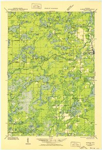
1930 Map of Robbins
USGS Topo · Published 1930About this map
The dense lake district of Vilas and Oneida Counties is shown here just as early conservation efforts were taking shape via the Northern State Park. This 1930 survey, based on early aerial photography by the U.S. Army Air Corps, reveals a landscape defined by water and woods, with tiny rural schools like Kuehn Sch. and Bohemian Sch. serving isolated families. The Chicago and Northwestern RR provides the primary industrial spine, connecting the settlement of Eagle River to the smaller siding at Robbins.
Find a feature on this map
124 named features on this map. Tap any name to fly to it.
Don’t see what you’re looking for? This feature index may not catch every label — zoom into the map to look around manually.
Map Details
Editions of this 1930 Robbins Map
2 editions found
Other maps of this area

1928 · Three Lakes
USGS Topo · 1:48,000

1938 · Phelps
USGS Topo · 1:48,000

1938 · Minocqua
USGS Topo · 1:48,000

1938 · Three Lakes
USGS Topo · 1:48,000

1938 · Robbins
USGS Topo · 1:48,000

1939 · Trout Lake
USGS Topo · 1:48,000

1939 · Cassian
USGS Topo · 1:48,000

1940 · Monico
USGS Topo · 1:48,000

1940 · Rhinelander
USGS Topo · 1:48,000

1942 · Cassian
USGS Topo · 1:48,000