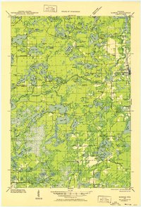
1930 Map of Robbins
USGS Topo · Published 1952About this map
Glacial lakes and rural schoolhouses define this northwoods landscape across the border of Vilas and Oneida counties. At the settlement of Robbins, industry and community converge near Sugar Camp Lake and the Pleasant View Sch, while the northwestern corner around Kuehn shows a dense network of waters including Lost Lake and Found Lake. This era of the Wisconsin wilderness is marked by the proliferation of neighborhood schools, such as the Bohemian Sch and Evergreen Sch, serving a population carved into the timberland.
Find a feature on this map
142 named features on this map. Tap any name to fly to it.
Don’t see what you’re looking for? This feature index may not catch every label — zoom into the map to look around manually.
Map Details
Editions of this 1930 Robbins Map
2 editions found
Other maps of this area

1928 · Three Lakes
USGS Topo · 1:48,000

1930 · Robbins
USGS Topo · 1:48,000

1938 · Phelps
USGS Topo · 1:48,000

1938 · Minocqua
USGS Topo · 1:48,000

1938 · Three Lakes
USGS Topo · 1:48,000

1938 · Robbins
USGS Topo · 1:48,000

1939 · Trout Lake
USGS Topo · 1:48,000

1939 · Cassian
USGS Topo · 1:48,000

1940 · Monico
USGS Topo · 1:48,000

1940 · Rhinelander
USGS Topo · 1:48,000