2020s Maps of Menomonee Falls, Wisconsin
Explore 4 historic maps of Menomonee Falls from the 2020s. These maps offer a rare glimpse into what life looked like during the 2020s — showing old roads, neighborhoods, homes, and landmarks that have changed or disappeared over time.
Whether you're researching your family's past, planning a metal detecting trip, or studying how Menomonee Falls's landscape evolved across the 2020s, these high-resolution maps are a powerful tool for exploring the history of this region.
- Focus on a specific era: All maps on this page are from the 2020s, giving you a focused view of this time period.
- See what’s changed: Compare century-old streets, trails, and buildings to today's modern landscape using overlays and satellite layers.
- Research with precision: Use these maps for genealogy, historical research, land use analysis, or educational projects.
- View, download, or print: Maps are fully viewable online in high resolution, and can be downloaded or printed for your own records.
Start exploring Menomonee Falls's history through authentic maps from the 2020s. This is your window into the past.
Menomonee Falls, WI maps
(4)- 2022 Map of Sussex, 2022 Print
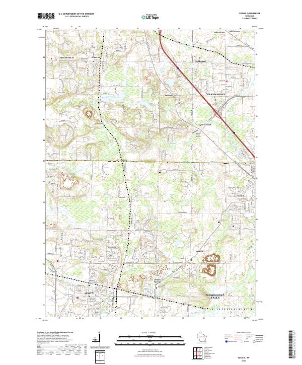 2022 Sussex2022 Print · USGSSoutheast Wisconsin's transition from rural townships to bustling residential centers is captured here during the early 2020s. Researchers can locate several burial grounds like Union Cemetery and trace the path of the Soo Line through Lannon and Sussex.
 - 2022 Map of Waukesha, 2022 Print
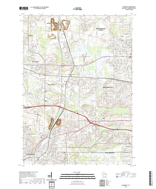 2022 Waukesha2022 Print · USGSSoutheast Wisconsin's suburban and industrial core is shown here as it appears in the early 2020s, centering on the city of Waukesha. Genealogists and researchers can trace local roots through numerous sites like Carroll University, Oak Hill Cem, and Saint Dominics Cem.
 - 2022 Map of Menomonee Falls, 2022 Print
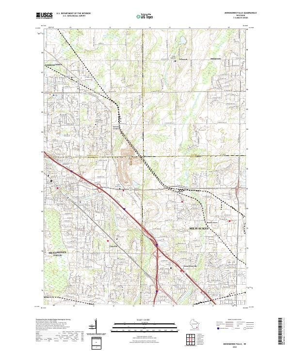 2022 Menomonee Falls2022 Print · USGSThe northern Milwaukee suburbs and the corners of four counties appear here in the early 2020s. Genealogists can locate numerous burial sites and former hamlets like Fussville, West Granville Cem, and Trinity Lutheran Cem Old.
 - 2022 Map of Wauwatosa, 2022 Print
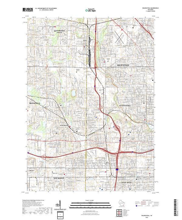 2022 Wauwatosa2022 Print · USGSWauwatosa and its western suburbs are documented in this recent survey as the urban fabric reaches full maturity. Genealogists and historians can trace institutional sites like Wauwatosa Cem, the Medical College of Wisconsin, and the Lawrence J Timmerman Airport.
End of results
Showing maps 1-4 of 4
Top cities near Menomonee Falls
- Milwaukee historical maps
- Waukesha historical maps
- West Allis historical maps
- Wauwatosa historical maps
- Brookfield historical maps
- New Berlin historical maps
See more
Top neighborhoods of Menomonee Falls
- Fussville historical maps
- Elm Lane historical maps
- Village Centre historical maps
- Quail Haven historical maps
- Creekwood Highlands historical maps
- Ravenwoods historical maps
See more
Frequently asked questions
- What are the different types of historical maps available for Menomonee Falls?
- What is the oldest map of Menomonee Falls?
- Where can I purchase historical maps of Menomonee Falls for my home or office?
- Where can I download high-res historical maps of Menomonee Falls?
- Are there historical topographic maps available for Menomonee Falls?
- Is there historical aerial imagery available for Menomonee Falls?
- Where are historical maps of Menomonee Falls sourced from?