1900s (20th Century) Maps of Ottawa, Wisconsin
Explore 22 historic maps of Ottawa from the 1900s (20th Century). These maps offer a rare glimpse into what life looked like during the 1900s — showing old roads, neighborhoods, homes, and landmarks that have changed or disappeared over time.
Whether you're researching your family's past, planning a metal detecting trip, or studying how Ottawa's landscape evolved across the 1900s, these high-resolution maps are a powerful tool for exploring the history of this region.
- Focus on a specific era: All maps on this page are from the 1900s, giving you a focused view of this time period.
- See what’s changed: Compare century-old streets, trails, and buildings to today's modern landscape using overlays and satellite layers.
- Research with precision: Use these maps for genealogy, historical research, land use analysis, or educational projects.
- View, download, or print: Maps are fully viewable online in high resolution, and can be downloaded or printed for your own records.
Start exploring Ottawa's history through authentic maps from the 1900s. This is your window into the past.
Ottawa, WI maps
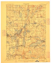
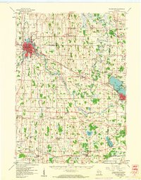
(22)- 1903 Map of Whitewater
 1903 Whitewater1903 Print · USGSSoutheastern Wisconsin at the turn of the century reveals a landscape of thriving rail towns and glacial lake systems. Trace the early routes of the Chicago Milwaukee and St Paul railroad between Whitewater and Palmyra, or locate old lakeside settlements like Heart Prairie.5 unique versions available
 - 1906 Map of Eagle
 1906 Eagle1906 Print · USGSSoutheastern Wisconsin's glaciated terrain is remarkably detailed in this early century survey of the Fox River valley. Genealogists and local historians can trace the early rail-stop settlements of Genesee Depot, North Prairie, and Eagleville alongside landmarks like Lake Beulah and Honey Creek.6 unique versions available
 - 1909 Map of Oconomowoc
 1909 Oconomowoc1909 Print · USGSThe Lake Country of Waukesha County is captured here at the height of its early resort era. You can trace family roots in Oconomowoc, locate the historic Nashotah Mission, and find long-lost stops like Waukesha Beach and Lakeside Sta.6 unique versions available
 - 1924 Map of Whitewater
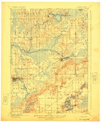 1924 Whitewater1924 Print · USGSSoutheastern Wisconsin at the turn of the century shows a landscape of glacial lakes and thriving rail-side towns. Genealogists and historians can trace old homesteads near Heaths Mills, the station at Palmyra, and the early township centers of Rome and Lagrange.4 unique versions available
 - 1954 Map of Rockford
 1954 Rockford1954 Print · USGSThe Rock River valley and the Illinois-Wisconsin borderlands are captured here in the mid-1950s during a period of robust industrial and agricultural activity. Genealogists and historians can trace rail-era corridors like the Illinois Central RR and locate landmarks from Big Foot Prairie to Lake Geneva.
 - 1955 Map of Rockford
 1955 Rockford1955 Print · USGSThe Rock River valley and southern Wisconsin dairy country are shown here in the mid-fifties as the region's manufacturing centers grew. Genealogists and historians can trace the paths of the Chicago and North Western RR and Illinois Central RR through hubs like Rockford and Beloit.
 - 1957 Map of Madison, 1967 Print
 1957 Madison1967 Print · USGSSouth-central Wisconsin in the mid-fifties reveals a landscape of industrial hubs and glacial lakes linked by a dense rail and highway network. Genealogists and historians can trace the development of lakeside communities and find notable sites like Badger Ordnance Works and the Horicon National Wildlife Refuge.3 unique versions available
 - 1958 Map of Rockford, 1974 Print
 1958 Rockford1974 Print · USGSNorthern Illinois and southern Wisconsin are shown here in the mid-twentieth century as rail-dependent industrial towns began to interface with growing lakefront communities. Genealogists can trace family roots through settlements like Saylesville and Tess Corners or locate historical landmarks like the Rockford Ordnance Depot.4 unique versions available
 - 1959 Map of Oconomowoc East, 1961 Print
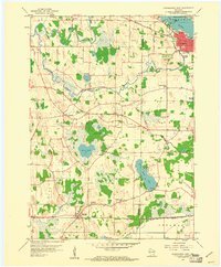
 1959 Oconomowoc East1961 Print · USGSWaukesha County's lake country is captured here in the late fifties, showcasing a landscape of glacial waters and growing towns. Local historians can locate St Johns Military Academy, the Wisconsin School for Boys, and family sites near Holy Innocents Cem.5 unique versions available
 - 1959 Map of Hartland, 1961 Print
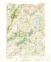
 1959 Hartland1961 Print · USGSWaukesha County at the close of the 1950s shows a landscape defined by glacial lakes and a maturing rail network. Genealogists and historians can trace old community hubs like Stonebank and Merton, identifying local landmarks from St Olaf Ch to University Lake Sch.
 - 1959 Map of Watertown, 1961 Print
 1959 Watertown1961 Print · USGSJefferson and Dodge Counties are captured in the late fifties as a thriving agricultural and rail corridor. Genealogists can trace family roots through numerous sites like Old Lebanon, St Bernard Cem, and rural schoolhouses including High Lawn Sch.3 unique versions available
 - 1959 Map of Oconomowoc West, 1961 Print
 1959 Oconomowoc West1961 Print · USGSJefferson and Waukesha counties come to life in the late fifties, showing a landscape of lakeside settlements and rural crossroads. Genealogists can trace family landmarks like St Johns Ch, Norwegian Cem, and the Concord Center Cem.2 unique versions available
 - 1960 Map of Madison
 1960 Madison1960 Print · USGSCentral and Southern Wisconsin are captured in the late fifties, showing the region as its rail-and-river network matured. Trace the paths of the Soo Line RR or locate family roots near Lake Mendota and Horicon National Wildlife Refuge.2 unique versions available
 - 1960 Map of Eagle, 1962 Print
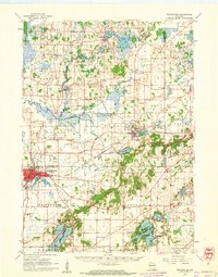
 1960 Eagle1962 Print · USGSSoutheast Wisconsin at the start of the 1960s shows a complex network of glacial lakes and bustling rail-stop towns. Genealogists can trace family names at Evergreen Cem and St Paul Cem, or locate rural schoolhouses like Sandy Island Sch.3 unique versions available
 - 1960 Map of Whitewater, 1962 Print
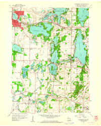
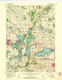
 1960 Whitewater1962 Print · USGSThe Whitewater area and its glacial lake country are captured here at the start of the 1960s. Genealogists and local researchers can trace the locations of Wisconsin State College, the Siloam Chapel, and numerous rural schoolhouses.4 unique versions available
 - 1960 Map of Eagle, 1964 Print
 1960 Eagle1964 Print · USGSWaukesha County's glacial terrain and rural hamlets are captured here at the start of the 1960s. Genealogists can trace family names and local landmarks like Jerusalem Cem, Salem Ch, and the small settlement of Jericho.3 unique versions available
 - 1960 Map of Palmyra, 1964 Print
 1960 Palmyra1964 Print · USGSWisconsin's glacial landscape is meticulously detailed in the early 1960s, showing the intersection of the Kettle Moraine State Forest and the Scuppernong River. Researchers can trace rural lineages through family landmarks like Heath Mills and old country burial grounds including Zion Cem and Melindas Prairie Cem.2 unique versions available
 - 1963 Map of Rockford
 1963 Rockford1963 Print · USGSThe mid-century industrial corridor along the Rock River is shown here during a period of rapid post-war growth. Researchers can trace the extensive rail lines of the Chicago and North Western or locate local landmarks like the Rockford Ordnance Depot and Holy Hill.
 - 1980 Map of Lake Geneva, 1981 Print
 1980 Lake Geneva1981 Print · USGSSoutheastern Wisconsin at the start of the eighties reveals a landscape of glacial moraines and established lakefront resorts. Researchers can trace historic rail lines like the Chicago and North Western RR or locate landmarks such as Yerkes Observatory and East Lawn Cem.
 - 1984 Map of Oconomowoc, 1985 Print
 1984 Oconomowoc1985 Print · USGSSoutheast Wisconsin in the mid-eighties shows a landscape defined by its glacial heritage and expanding metropolitan corridors. Genealogists and historians can trace the development of lakeside communities like Oconomowoc and Pewaukee, or find established settlements such as Watertown and Beaver Dam.
 - 1991 Map of Oconomowoc
 1991 Oconomowoc1991 Print · USGSSoutheastern Wisconsin in the early nineties shows a landscape of glacial lakes and growing suburbs. Trace local history through Aztalan State Park, Carroll College, and the sprawling Horicon Marsh State Wildlife Area.
 - 1995 Map of Palmyra, 1999 Print
 1995 Palmyra1999 Print · USGSSoutheast Wisconsin in the 1990s reveals a landscape of terminal moraines and kettle lakes at the edge of the Kettle Moraine. Researchers can locate family landmarks like Melindas Prairie Cem, trace the community around Oak Hill, or explore the shores of Pretty Lake.
End of results
Showing maps 1-22 of 22
Top cities near Ottawa
- Waukesha historical maps
- Watertown historical maps
- Oconomowoc historical maps
- City of Pewaukee historical maps
- Whitewater historical maps
- Richfield historical maps
See more
Frequently asked questions
- What are the different types of historical maps available for Ottawa?
- What is the oldest map of Ottawa?
- Where can I purchase historical maps of Ottawa for my home or office?
- Where can I download high-res historical maps of Ottawa?
- Are there historical topographic maps available for Ottawa?
- Is there historical aerial imagery available for Ottawa?
- Where are historical maps of Ottawa sourced from?