1900s (20th Century) Maps of Waushara County, Wisconsin
Explore 38 historic maps of Waushara County from the 1900s (20th Century). These maps offer a rare glimpse into what life looked like during the 1900s — showing old roads, neighborhoods, homes, and landmarks that have changed or disappeared over time.
Whether you're researching your family's past, planning a metal detecting trip, or studying how Waushara County's landscape evolved across the 1900s, these high-resolution maps are a powerful tool for exploring the history of this region.
- Focus on a specific era: All maps on this page are from the 1900s, giving you a focused view of this time period.
- See what’s changed: Compare century-old streets, trails, and buildings to today's modern landscape using overlays and satellite layers.
- Research with precision: Use these maps for genealogy, historical research, land use analysis, or educational projects.
- View, download, or print: Maps are fully viewable online in high resolution, and can be downloaded or printed for your own records.
Start exploring Waushara County's history through authentic maps from the 1900s. This is your window into the past.
Waushara County, WI maps
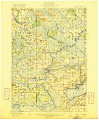
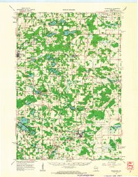
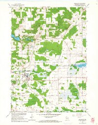
(38)- 1915 Map of Neshkoro
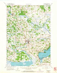
 1915 Neshkoro1915 Print · USGSCentral Wisconsin at the height of the river-and-rail era shows a network of locks and rural schoolhouses. Trace the early layouts of Princeton and Neshkoro, or locate landmarks like White River Lock and Puckaway Lake.
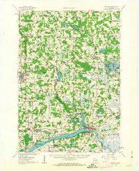
 - 1916 Map of Ripon
 1916 Ripon1916 Print · USGSWisconsin’s Fox River Valley and the lakelands of Fond du Lac and Winnebago counties are captured here just before the close of the Great War. Genealogists can trace family roots through dozens of rural landmarks, from Center House to Fera School and the Eureka Lock.
 - 1918 Map of Neshkoro
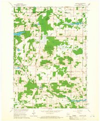
 1918 Neshkoro1918 Print · USGSThe Fox River valley and its complex lock system are recorded here during a period of active river and rail commerce. Genealogists can locate numerous rural schoolhouses and vanished rail stops near Princeton, Neshkoro, and the White River Lock.3 unique versions available
 - 1918 Map of Ripon
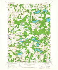
 1918 Ripon1918 Print · USGSFond du Lac and Green Lake counties are shown here at the end of the Great War, when the rail lines still dictated the pace of commerce. Researchers can trace the early boundaries of Berlin and Ripon or locate rural landmarks like the Arcade School and Koro.
 - 1955 Map of Green Bay, 1968 Print
 1955 Green Bay1968 Print · USGSCentral and Eastern Wisconsin are captured here in the mid-fifties, showing the industrial growth of the Fox Valley and Wisconsin River corridors. Genealogists and historians can trace rail lines like the Green Bay and Western through settlements like Weyauwega, Clintonville, and Pulaski.2 unique versions available
 - 1956 Map of Ripon, 1957 Print
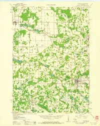
 1956 Ripon1957 Print · USGSRipon and the surrounding Wisconsin lakelands are shown in the mid-fifties as the region's rail and agricultural patterns remained firmly intact. Researchers can locate numerous rural schoolhouses like Prairie Lawn Sch and trace the legacy of Ripon College or the historic settlement of Sacramento.
 - 1957 Map of Madison, 1967 Print
 1957 Madison1967 Print · USGSSouth-central Wisconsin in the mid-fifties reveals a landscape of industrial hubs and glacial lakes linked by a dense rail and highway network. Genealogists and historians can trace the development of lakeside communities and find notable sites like Badger Ordnance Works and the Horicon National Wildlife Refuge.3 unique versions available
 - 1958 Map of Coloma, 1960 Print
 1958 Coloma1960 Print · USGSThe Central Wisconsin sand plains are shown during the late 1950s as small towns like Plainfield and Coloma flourished along the Chicago and North Western rail line. Genealogists can locate rural schoolhouses such as Rathermel Sch and family landmarks like Owens Rock.
 - 1959 Map of Wautoma, 1961 Print
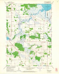
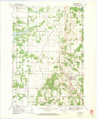
 1959 Wautoma1961 Print · USGSWaushara County in the late fifties shows a rural landscape defined by glacial lakes and a developing transportation network. Genealogists can trace family names through numerous sites like Richford Cem, West Holden Ch, and St Pauls Cem.
 - 1960 Map of Madison
 1960 Madison1960 Print · USGSCentral and Southern Wisconsin are captured in the late fifties, showing the region as its rail-and-river network matured. Trace the paths of the Soo Line RR or locate family roots near Lake Mendota and Horicon National Wildlife Refuge.2 unique versions available
 - 1961 Map of Poy Sippi, 1963 Print
 1961 Poy Sippi1963 Print · USGSThe Lake Poygan region of Wisconsin comes alive in this early 1960s survey, showing the intricate river-and-marsh economy before modern expansion. Researchers can trace family sites at Fountain Valley Sch & Ch, the Welsh Cem, or follow the banks of the Poy Sippi River through historic lakefront settlements like Tustin.2 unique versions available
 - 1961 Map of Oxford, 1963 Print
 1961 Oxford1963 Print · USGSMarquette and Adams counties are shown here in the early sixties, a landscape of glacial lakes and small farming townships. Genealogists and historians can trace the locations of St Methodius Ch, Lincoln Sch, and the winding Chicago and North Western rail line.2 unique versions available
 - 1961 Map of Redgranite, 1963 Print
 1961 Redgranite1963 Print · USGSWaushara County’s kettle lake country is captured here in the early sixties, showing a landscape shaped by stone quarries and summer camps. Researchers can trace the Chicago and North Western rail line and find local landmarks like St Marks Cem and the Wild Rose State Fish Hatchery.2 unique versions available
 - 1961 Map of Montello, 1963 Print
 1961 Montello1963 Print · USGSMarquette and Waushara Counties in the early sixties reveal a landscape of glaciated lake country and rural crossroads. Genealogists and researchers can trace family-named sites like Metz-Tagatz Cem, visit the Charcoal Ovens, or follow the Old Railroad Grade.2 unique versions available
 - 1961 Map of Saxeville, 1966 Print
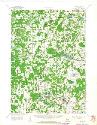
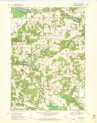
 1961 Saxeville1966 Print · USGSThe rural town of Saxeville and the surrounding Waushara County countryside are captured here in the early sixties. Genealogists and researchers can trace family roots at Cedar Cem or Hilltop Cem, and locate landmarks like the Wild Rose Sch and Emaus Ch.2 unique versions available
 - 1961 Map of Wild Rose, 1966 Print
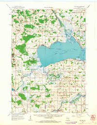
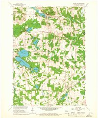
 1961 Wild Rose1966 Print · USGSThe village of Wild Rose and its lake-strewn surroundings are captured here in the early sixties before modern development reshaped the landscape. Researchers can locate family landmarks such as Springwater Cem, the Wild Rose State Fish Hatchery, and numerous summer camps like Camp Windego.2 unique versions available
 - 1961 Map of Redgranite, 1966 Print
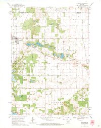
 1961 Redgranite1966 Print · USGSRedgranite and the surrounding townships of Leon and Warren appear here in the early sixties as centers of local quarrying and agriculture. Researchers can trace family sites near St Marks Cem, locate the old Landing Strip, or explore the shoreline of Pearl Lake.2 unique versions available
 - 1961 Map of Auroraville, 1966 Print
 1961 Auroraville1966 Print · USGSWisconsin's wetlands and rural townships are captured here in the early sixties as the landscape transitioned between traditional farming and specialized bog cultivation. Trace family roots at the Welsh Cem or locate old community hubs like Fountain Valley and Auroraville.2 unique versions available
 - 1961 Map of Spring Lake, 1966 Print
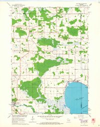
 1961 Spring Lake1966 Print · USGSWaushara County in the early sixties was a landscape of scattered rural hamlets and numerous glacial lakes. Genealogists and historians can locate the Mountain View Sch, Raymond Cem, and the Chicago and North Western rail line.2 unique versions available
 - 1961 Map of Poy Sippi, 1968 Print
 1961 Poy Sippi1968 Print · USGSThe marshlands and crossroads of Waushara County are captured here in the early 1960s as they meet the shores of Lake Poygan. Researchers can locate historic rural centers like Poy Sippi and Tustin, alongside parish sites like Emmaus Ch and St Johns Sch.2 unique versions available
 - 1963 Map of Neshkoro, 1964 Print
 1963 Neshkoro1964 Print · USGSCentral Wisconsin's river valleys and lakefronts are shown here in the early sixties, as the rail and water networks still shaped local life. Genealogists and historians can locate rural landmarks like St Johns Cem, the Rabbitt Sch, and the Bed-ah-Wick Landing Field.2 unique versions available
 - 1968 Map of Coloma, 1971 Print
 1968 Coloma1971 Print · USGSThe rural landscape of Waushara County in the late sixties is defined by its small settlements and distinct township boundaries. Genealogists and local historians can locate several country burial grounds like White Cem and the De George Sch, while tracing the path of the Old Railroad Grade.
 - 1968 Map of Richford, 1971 Print
 1968 Richford1971 Print · USGSRichford and the surrounding township of Deerfield are shown here in the late sixties, defined by a dense network of glacial lakes and small farmsteads. Researchers can locate the Greenwood State Wildlife Refuge, Fish Lake Cem, and the Merriam Boy Scout Camp.2 unique versions available
 - 1968 Map of Plainfield, 1971 Print
 1968 Plainfield1971 Print · USGSWisconsin's glacial lake country comes into focus in the late sixties as the area around Plainfield developed its agricultural and recreational identity. Researchers can trace rural lineages through Hillside Cem and Lord Cem or explore the many shorelines of Lake Huron and Long Lake.2 unique versions available
 - 1968 Map of Wautoma, 1971 Print
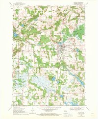 1968 Wautoma1971 Print · USGSWautoma and its surrounding glacial lakes are seen here in the late sixties, as the local economy balanced rail transport with emerging recreation. Local researchers can locate several rural burial grounds like North Dakota Cemetery and trace the old Chicago and North Western line.
Showing maps 1-25 of 38
Top cities of Waushara County
- Wautoma historical maps
- Redgranite historical maps
- Wild Rose historical maps
- Plainfield historical maps
- Coloma historical maps
- Hancock historical maps
See more
Frequently asked questions
- What are the different types of historical maps available for Waushara County?
- What is the oldest map of Waushara County?
- Where can I purchase historical maps of Waushara County for my home or office?
- Where can I download high-res historical maps of Waushara County?
- Are there historical topographic maps available for Waushara County?
- Is there historical aerial imagery available for Waushara County?
- Where are historical maps of Waushara County sourced from?