1990s Maps of Winnebago County, Wisconsin
Explore 6 historic maps of Winnebago County from the 1990s. These maps offer a rare glimpse into what life looked like during the 1990s — showing old roads, neighborhoods, homes, and landmarks that have changed or disappeared over time.
Whether you're researching your family's past, planning a metal detecting trip, or studying how Winnebago County's landscape evolved across the 1990s, these high-resolution maps are a powerful tool for exploring the history of this region.
- Focus on a specific era: All maps on this page are from the 1990s, giving you a focused view of this time period.
- See what’s changed: Compare century-old streets, trails, and buildings to today's modern landscape using overlays and satellite layers.
- Research with precision: Use these maps for genealogy, historical research, land use analysis, or educational projects.
- View, download, or print: Maps are fully viewable online in high resolution, and can be downloaded or printed for your own records.
Start exploring Winnebago County's history through authentic maps from the 1990s. This is your window into the past.
Winnebago County, WI maps
(6)- 1992 Map of Van Dyne, 1996 Print
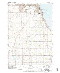 1992 Van Dyne1996 Print · USGSThe western shores of Lake Winnebago appear in the early nineties as the communities of Oshkosh and Van Dyne were steadily growing. Genealogists can trace family roots at numerous rural burial sites like Salem Cem, Schellers Cem, and New Elm Cem.
 - 1992 Map of Neenah, 1996 Print
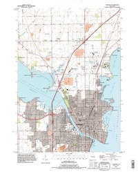
 1992 Neenah1996 Print · USGSThe Fox River Valley saw significant development in the early nineties, centered on the growing industrial and residential districts of Neenah and Menasha. Genealogists and local historians can trace family locations through numerous sites like St Patricks Cem, Stroebe Island, and the rail corridors of the Soo Line.
 - 1992 Map of Oshkosh, 1996 Print
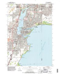
 1992 Oshkosh1996 Print · USGSThe Fox River waterfront and the urban core of Oshkosh are shown here in the 1990s. Researchers can trace the grounds of the Winnebago State Hospital, the University of Wisconsin Oshkosh, and the Soo Line rail corridor.
 - 1992 Map of Fahrney Point, 1996 Print
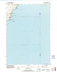
 1992 Fahrney Point1996 Print · USGSThe Lake Winnebago shoreline in the early nineties features a mix of quiet summer retreats and established lakeside communities. Researchers can locate family landmarks such as Oaklawn Cemetery, the Jesuit Retreat, and named points like Streich Point.
 - 1992 Map of Indian Point, 1996 Print
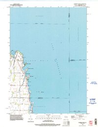
 1992 Indian Point1996 Print · USGSThe western shores of Lake Winnebago are captured in detail during the early nineties, showing a landscape defined by coastal points and recreational landings. Researchers can trace local property lines and shoreline features like Indian Point, Cowling Bay, and the Osh-O-Nee Midway Boat Ramp.
 - 1992 Map of Oshkosh NE, 1996 Print
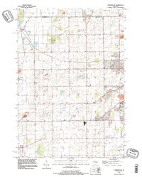 1992 Oshkosh NE1996 Print · USGSWinnebago County in the early nineties shows a landscape of rail-connected hamlets and growing aviation hubs northwest of Lake Winnebago. Researchers can trace the Soo Line through Medina Junction and find local landmarks like Larsen and Allenville.
End of results
Showing maps 1-6 of 6
Top cities of Winnebago County
- Oshkosh historical maps
- Neenah historical maps
- Fox Crossing historical maps
- Omro historical maps
- Black Wolf historical maps
- Winneconne historical maps
See more
Frequently asked questions
- What are the different types of historical maps available for Winnebago County?
- What is the oldest map of Winnebago County?
- Where can I purchase historical maps of Winnebago County for my home or office?
- Where can I download high-res historical maps of Winnebago County?
- Are there historical topographic maps available for Winnebago County?
- Is there historical aerial imagery available for Winnebago County?
- Where are historical maps of Winnebago County sourced from?