2020s Maps of Hyattville, Wyoming
Explore 4 historic maps of Hyattville from the 2020s. These maps offer a rare glimpse into what life looked like during the 2020s — showing old roads, neighborhoods, homes, and landmarks that have changed or disappeared over time.
Whether you're researching your family's past, planning a metal detecting trip, or studying how Hyattville's landscape evolved across the 2020s, these high-resolution maps are a powerful tool for exploring the history of this region.
- Focus on a specific era: All maps on this page are from the 2020s, giving you a focused view of this time period.
- See what’s changed: Compare century-old streets, trails, and buildings to today's modern landscape using overlays and satellite layers.
- Research with precision: Use these maps for genealogy, historical research, land use analysis, or educational projects.
- View, download, or print: Maps are fully viewable online in high resolution, and can be downloaded or printed for your own records.
Start exploring Hyattville's history through authentic maps from the 2020s. This is your window into the past.
Hyattville, WY maps
(4)- 2021 Map of Weintz Draw, 2021 Print
 2021 Weintz Draw2021 Print · USGSBig Horn and Washakie counties meet in this 2021 survey of the Nowood River valley as the modern ranching landscape continues to evolve. Researchers can trace intricate water systems like Anita Ditch and identify livestock reservoirs including H G Reservoir and Brewster Reservoir.
 - 2021 Map of Hyatt Ranch, 2021 Print
 2021 Hyatt Ranch2021 Print · USGSThe ranching and irrigation history of Hyattville, Wyoming, is well preserved in this modern topographic study. Researchers can trace the lineage of local families at Hyattville Cem or follow the complex network of early water works like Walters Supply Ditch and Military Ditch.
 - 2021 Map of Hyattville, 2021 Print
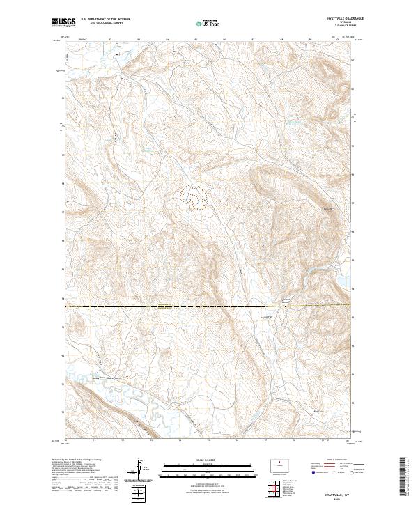 2021 Hyattville2021 Print · USGSThe high basins and canyonlands of northern Wyoming appear here in modern detail. Trace local water history through family-named features and livestock improvements like Doyle Reservoir, South Paint Rock Reservoir, and the course of the Nowood River.
 - 2021 Map of Flitner Reservoir, 2021 Print
 2021 Flitner Reservoir2021 Print · USGSThe high desert of Big Horn County is documented here in the early twenty-first century, showcasing a landscape defined by water management. Genealogists and land researchers can trace the course of the Anita Ditch and locate landmarks like Blue Ridge or Flitner Reservoir.
End of results
Showing maps 1-4 of 4
Top cities near Hyattville
Frequently asked questions
- What are the different types of historical maps available for Hyattville?
- What is the oldest map of Hyattville?
- Where can I purchase historical maps of Hyattville for my home or office?
- Where can I download high-res historical maps of Hyattville?
- Are there historical topographic maps available for Hyattville?
- Is there historical aerial imagery available for Hyattville?
- Where are historical maps of Hyattville sourced from?