Old Maps of Hyattville, Wyoming for Academic Research
Study the evolution of Hyattville with 24 high-resolution historic maps. Whether you're teaching, researching, or modeling changes in land use, these maps provide essential visual documentation of urban, environmental, and geographic change.
- Analyze long-term change: Track patterns in development, transportation, and natural features.
- Ideal for environmental or urban studies: Support academic projects with primary historical map data.
- Use in the classroom or lab: Educators and researchers rely on these maps to bring historical context to life.
These maps are a powerful tool for teaching, research, and visualizing how Hyattville has changed over the decades.
Hyattville, WY maps
(24)- 1955 Map of Sheridan, 1973 Print
 1955 Sheridan1973 Print · USGSThe Bighorn Mountains meet the Powder River Basin in the 1950s, a period when cattle ranching and coal mining defined the regional economy. Genealogists and historians can trace local landmarks like the Fort Mackenzie Veteran Hospital, the Monarch Coal Mine, and legacy operations such as the Beckton Stock Farm.2 unique versions available
 - 1958 Map of Sheridan
 1958 Sheridan1958 Print · USGSThe Bighorn Mountains meet the high plains in the mid-1950s, revealing a landscape of large-scale ranching and mineral extraction. Trace the legacy of early settlements and industry through the Kleenburn Coal Tipple, Beckton Stock Farm, and the Hidden Dome Oil & Gas Field.2 unique versions available
 - 1960 Map of Flitner Reservoir, 1962 Print
 1960 Flitner Reservoir1962 Print · USGSBig Horn County ranching and water rights are captured here in the early sixties as the Missouri River Basin project modernized the West. Trace the legacy of the Walters Ranch and remote water infrastructure like the Anita Ditch and Flitner Reservoir.
 - 1960 Map of Hyatt Ranch, 1962 Print
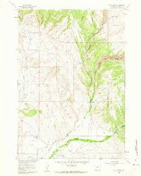 1960 Hyatt Ranch1962 Print · USGSBig Horn County ranching and rugged canyons are captured in this early 1960s survey during the development of the Missouri River Basin. Genealogists and historians can locate family holdings like Taylor Ranch or trace the early paths leading to the Hyattville Cem and Medicine Lodge Canyon.4 unique versions available
 - 1962 Map of Sheridan
 1962 Sheridan1962 Print · USGSThe Big Horn Mountains and Powder River country are captured here in the early sixties as energy production and ranching shaped northern Wyoming. Researchers can locate specific sites like the Kleenburn Coal Tipple, Eaton Bros Ranch, and the Fort McKenzie Veteran Hospital.
 - 1967 Map of Hyattville, 1971 Print
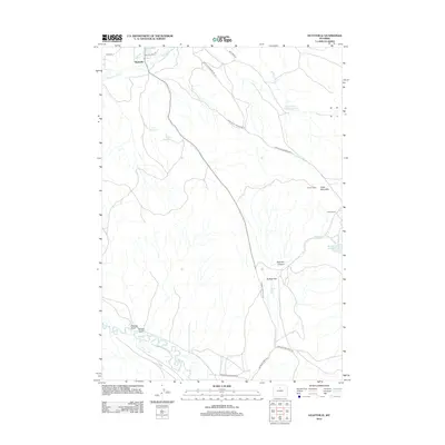
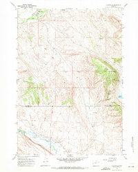 1967 Hyattville1971 Print · USGSHyattville was a quiet ranching hub at the foot of the Bighorn Mountains in the late 1960s. Genealogists and researchers can trace the old water routes and ranching footprints from Smiths Ranch to the banks of the Nowood River.2 unique versions available
 - 1967 Map of Weintz Draw, 1971 Print
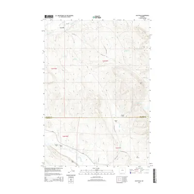
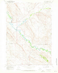 1967 Weintz Draw1971 Print · USGSBig Horn and Washakie counties are captured here in the late sixties, showcasing a landscape of high ridges and riparian industry. You can trace the Bonanza Oil Field and follow the intricate path of the Nowood River past the Ninetysx Canal.2 unique versions available
 - 1979 Map of Worland
 1979 Worland1979 Print · USGSThe Bighorn Basin in the late seventies reveals a landscape of river-valley agriculture and high-mountain wilderness. Researchers can trace the energy-driven growth of Worland and Ten Sleep, or locate family landmarks near Hyattville and the Big Horn Mine.2 unique versions available
 - 2012 Map of Hyatt Ranch, 2012 Print
 2012 Hyatt Ranch2012 Print · USGSCovers Hyattville, including Big Horn County, United States, and other nearby areas
 - 2012 Map of Flitner Reservoir, 2012 Print
 2012 Flitner Reservoir2012 Print · USGSCovers Hyattville, including Big Horn County, United States, and other nearby areas
 - 2012 Map of Weintz Draw, 2012 Print
 2012 Weintz Draw2012 Print · USGSCovers Hyattville, including Washakie County, Big Horn County, and other nearby areas
 - 2012 Map of Hyattville, 2012 Print
 2012 Hyattville2012 Print · USGSCovers Hyattville, including Washakie County, Big Horn County, and other nearby areas
 - 2015 Map of Hyatt Ranch, 2015 Print
 2015 Hyatt Ranch2015 Print · USGSCovers Hyattville, including Big Horn County, United States, and other nearby areas
 - 2015 Map of Flitner Reservoir, 2015 Print
 2015 Flitner Reservoir2015 Print · USGSCovers Hyattville, including Big Horn County, United States, and other nearby areas
 - 2015 Map of Hyattville, 2015 Print
 2015 Hyattville2015 Print · USGSCovers Hyattville, including Washakie County, Big Horn County, and other nearby areas
 - 2015 Map of Weintz Draw, 2015 Print
 2015 Weintz Draw2015 Print · USGSCovers Hyattville, including Washakie County, Big Horn County, and other nearby areas
 - 2017 Map of Flitner Reservoir, 2017 Print
 2017 Flitner Reservoir2017 Print · USGSCovers Hyattville, including Big Horn County, United States, and other nearby areas
 - 2017 Map of Hyatt Ranch, 2017 Print
 2017 Hyatt Ranch2017 Print · USGSCovers Hyattville, including Big Horn County, United States, and other nearby areas
 - 2017 Map of Hyattville, 2017 Print
 2017 Hyattville2017 Print · USGSCovers Hyattville, including Washakie County, Big Horn County, and other nearby areas
 - 2017 Map of Weintz Draw, 2017 Print
 2017 Weintz Draw2017 Print · USGSCovers Hyattville, including Washakie County, Big Horn County, and other nearby areas
 - 2021 Map of Weintz Draw, 2021 Print
 2021 Weintz Draw2021 Print · USGSBig Horn and Washakie counties meet in this 2021 survey of the Nowood River valley as the modern ranching landscape continues to evolve. Researchers can trace intricate water systems like Anita Ditch and identify livestock reservoirs including H G Reservoir and Brewster Reservoir.
 - 2021 Map of Hyatt Ranch, 2021 Print
 2021 Hyatt Ranch2021 Print · USGSThe ranching and irrigation history of Hyattville, Wyoming, is well preserved in this modern topographic study. Researchers can trace the lineage of local families at Hyattville Cem or follow the complex network of early water works like Walters Supply Ditch and Military Ditch.
 - 2021 Map of Hyattville, 2021 Print
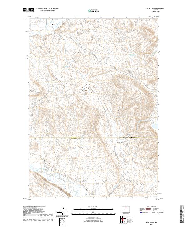 2021 Hyattville2021 Print · USGSThe high basins and canyonlands of northern Wyoming appear here in modern detail. Trace local water history through family-named features and livestock improvements like Doyle Reservoir, South Paint Rock Reservoir, and the course of the Nowood River.
 - 2021 Map of Flitner Reservoir, 2021 Print
 2021 Flitner Reservoir2021 Print · USGSThe high desert of Big Horn County is documented here in the early twenty-first century, showcasing a landscape defined by water management. Genealogists and land researchers can trace the course of the Anita Ditch and locate landmarks like Blue Ridge or Flitner Reservoir.
End of results
Showing maps 1-24 of 24
Top cities near Hyattville
Frequently asked questions
- What are the different types of historical maps available for Hyattville?
- What is the oldest map of Hyattville?
- Where can I purchase historical maps of Hyattville for my home or office?
- Where can I download high-res historical maps of Hyattville?
- Are there historical topographic maps available for Hyattville?
- Is there historical aerial imagery available for Hyattville?
- Where are historical maps of Hyattville sourced from?