
1960 Map of Flitner Reservoir
USGS Topo · Published 1962About this map
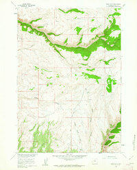
Walters Ranch sits at the eastern edge of this arid landscape in Big Horn County, part of a 1960s-era study of the Missouri River Basin. The terrain is defined by complex drainage systems and water management infrastructure, including Flitner Reservoir and its Spillway near the northern border, and the Anita Ditch in the south. The map documents a rugged topography characterized by the Blue Ridge and deep incisions like East Fork McDermotts Gulch, which reveal the area's geological composition through noted Claypits. Local ranching and surveying history are visible through family-named landmarks like Walters Reservoir and the VABM Wonder triangulation station. A network of Jeep Trails provides the primary access through this dry rangeland, connecting remote Springs and various wells that supported livestock and mineral exploration in the mid-century West.
Find a feature on this map
13 named features on this map. Tap any name to fly to it.
Don’t see what you’re looking for? This feature index may not catch every label — zoom into the map to look around manually.
Map Details
Editions of this 1960 Flitner Reservoir Map
This is the sole edition of this map. No revisions or reprints were ever made.
Other maps of this area

1955 · Sheridan
USGS Topo · 1:250,000

1958 · Sheridan
USGS Topo · 1:250,000

1960 · White Sulphur Spring
USGS Topo · 1:24,000

1960 · Hyatt Ranch
USGS Topo · 1:24,000

1960 · Manderson NE
USGS Topo · 1:24,000
1960 · Bush Butte
USGS Topo · 1:24,000

1960 · Manderson SE
USGS Topo · 1:24,000

1962 · Sheridan
USGS Topo · 1:250,000
1967 · Hyattville
USGS Topo · 1:24,000
1967 · Weintz Draw
USGS Topo · 1:24,000