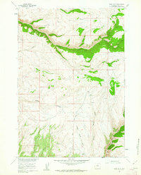
1960 Map of Bush Butte
USGS Topo · Published 1962About this map
Bush Butte rises prominently above a landscape defined by deep drainages and high plateaus in this western Wyoming quadrangle. The map captures the complex topography of the Big Horn Basin foothills, where significant water features like Medicine Lodge Creek and Dry Medicine Lodge Creek cut through the terrain. A sophisticated network of early transport is visible through numerous unnamed trails and jeep trails that navigate around Trapper Creek Canyon and Webber Canyon. This 1960 field-checked survey was conducted by the Geological Survey as part of a Department of the Interior program to develop the Missouri River Basin. The presence of isolated landmarks such as Myers Spring and Sheep Springs suggests a reliance on scattered water sources for grazing and travel in the high-elevation backcountry beneath Black Mountain.
Find a feature on this map
21 named features on this map. Tap any name to fly to it.
Don’t see what you’re looking for? This feature index may not catch every label — zoom into the map to look around manually.
Map Details
Editions of this 1960 Bush Butte Map
3 editions found
Other maps of this area

1895 · Dayton
USGS Topo · 1:125,000

1898 · Bald Mountain
USGS Topo · 1:125,000

1899 · Cloud peak
USGS Topo · 1:125,000

1901 · Cloud Peak
USGS Topo · 1:125,000

1901 · Dayton
USGS Topo · 1:125,000

1901 · Bald Mountain
USGS Topo · 1:125,000

1955 · Sheridan
USGS Topo · 1:250,000

1958 · Sheridan
USGS Topo · 1:250,000

1960 · Shell Falls
USGS Topo · 1:24,000

1960 · White Sulphur Spring
USGS Topo · 1:24,000