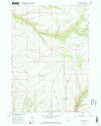
1960 Map of Bush Butte
USGS Topo · Published 1975About this map
Bush Butte and Black Mountain anchor this high-elevation terrain in Big Horn County, mapped for the development of the Missouri River Basin. The landscape is defined by deep incisions such as Trapper Canyon and Sheep Canyon, where water sources like Sheep Springs and Myers Spring provided vital points of access in an otherwise arid environment. The presence of numerous Jeep Trails winding through Webber Canyon and along Alkali Creek suggests a mid-century reliance on off-road transport for ranching or resource management. In the southeast, Dry Medicine Lodge Canyon cuts a significant path through the plateau, while the VABM Battle benchmark serves as a high-point survey marker. This 1960 field-checked data captures the network of remote springs and seasonal drainages, including Trapper Creek and Bush Creek, that sustained this portion of the Wyoming range.
Find a feature on this map
21 named features on this map. Tap any name to fly to it.
Don’t see what you’re looking for? This feature index may not catch every label — zoom into the map to look around manually.
Map Details
Editions of this 1960 Bush Butte Map
3 editions found
Other maps of this area

1895 · Dayton
USGS Topo · 1:125,000

1898 · Bald Mountain
USGS Topo · 1:125,000

1899 · Cloud peak
USGS Topo · 1:125,000

1901 · Cloud Peak
USGS Topo · 1:125,000

1901 · Dayton
USGS Topo · 1:125,000

1901 · Bald Mountain
USGS Topo · 1:125,000

1955 · Sheridan
USGS Topo · 1:250,000

1958 · Sheridan
USGS Topo · 1:250,000

1960 · Shell Falls
USGS Topo · 1:24,000

1960 · White Sulphur Spring
USGS Topo · 1:24,000