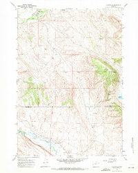
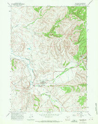
1967 Map of Hyattville
USGS Topo · Published 1971About this map
Hyattville serves as the focal point of this Big Horn Basin landscape, situated at the confluence of Medicine Lodge Creek and Paint Rock Creek. The area’s water management history is documented through systems like The West Ditch and several high-desert water sources including Pearce Well and South Paint Rock Reservoir. This mid-century survey captures the rural layout before major modern development, highlighting isolated outposts like Smiths Ranch near the base of Cedar Mountain.
Find a feature on this map
27 named features on this map. Tap any name to fly to it.
Don’t see what you’re looking for? This feature index may not catch every label — zoom into the map to look around manually.
Map Details
Editions of this 1967 Hyattville Map
2 editions found
Other maps of this area

1899 · Cloud peak
USGS Topo · 1:125,000

1901 · Cloud Peak
USGS Topo · 1:125,000

1955 · Sheridan
USGS Topo · 1:250,000

1958 · Sheridan
USGS Topo · 1:250,000

1960 · Flitner Reservoir
USGS Topo · 1:24,000

1960 · Hyatt Ranch
USGS Topo · 1:24,000

1962 · Sheridan
USGS Topo · 1:250,000
1967 · Weintz Draw
USGS Topo · 1:24,000
1967 · Broom Draw
USGS Topo · 1:24,000
1967 · Ten Sleep
USGS Topo · 1:24,000