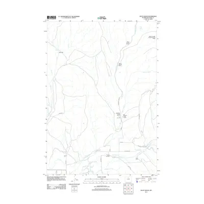
2012 Map of Hyatt Ranch
USGS Topo · Published 2012About this map
Hyattville Cem stands on the western edge of this territory, where the transition from desert to mountain foothills is defined by a sophisticated network of man-made waterways. Ranching life is anchored by named properties like Hyatt Ranch, Greer Ranch, and Taylor Ranch, which rely on an irrigation system including the Walters Supply Ditch, Highland Ditch, and Big Bear Ditch. These channels pull from Medicine Lodge Cr and Paint Rock Cr to sustain the valley. To the north and east, the landscape rises into the Medicine Lodge Big Game Winter Range and the dramatic walls of Medicine Lodge Canyon. This area, where Alkali Flats meet rugged draws like Myers Spring Draw, illustrates the essential relationship between water rights and land use in Big Horn County.
Find a feature on this map
36 named features on this map. Tap any name to fly to it.
Don’t see what you’re looking for? This feature index may not catch every label — zoom into the map to look around manually.
Map Details
Editions of this 2012 Hyatt Ranch Map
This is the sole edition of this map. No revisions or reprints were ever made.
Other maps of this area

1899 · Cloud peak
USGS Topo · 1:125,000

1901 · Cloud Peak
USGS Topo · 1:125,000

1955 · Sheridan
USGS Topo · 1:250,000

1958 · Sheridan
USGS Topo · 1:250,000

1960 · White Sulphur Spring
USGS Topo · 1:24,000

1960 · Flitner Reservoir
USGS Topo · 1:24,000

1960 · Spanish Point
USGS Topo · 1:24,000

1960 · Hyatt Ranch
USGS Topo · 1:24,000
1960 · Bush Butte
USGS Topo · 1:24,000

1962 · Sheridan
USGS Topo · 1:250,000