Old Maps of Hanna, Wyoming for Genealogy
Trace your family roots with 18 historic maps of Hanna. These high-res maps reveal old neighborhoods, homesites, landmarks, and streets — helping you uncover where your ancestors lived and how the area evolved over time.
- Explore historic neighborhoods: Identify where your relatives may have lived in the 1800s or 1900s.
- Compare maps over time: Trace the changes in streets, buildings, and landmarks for multi-generational research.
- Perfect for genealogy & ancestry research: Used by family historians and researchers to map out lineage and migration.
These maps are an incredible resource for exploring your personal connection to Hanna's past.
Hanna, WY maps
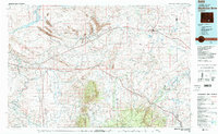
(18)- 1893 Map of Fort Steele
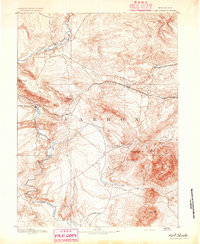 1893 Fort Steele1893 Print · USGSCarbon County in the early 1890s is a rugged landscape dominated by the high-altitude peaks of the Snowy Range and the iron path of the Union Pacific Ry. Genealogists and historians can trace the early rail stops at Hanna, Dana, and Ft Steele alongside the winding course of the North Platte River.4 unique versions available
 - 1914 Map of Hanna
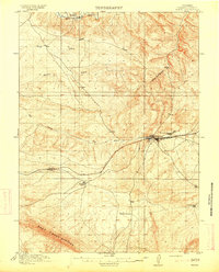 1914 Hanna1914 Print · USGSCarbon County ranching and railroad life come into focus in the years before the Great War. You can trace the early irrigation networks and family outposts like Brooks Ranch and Kinney's Ranch or locate the original layouts of Hanna and Threetown.3 unique versions available
 - 1954 Map of Rawlins, 1968 Print
 1954 Rawlins1968 Print · USGSThe high plains and mountain ranges of southern Wyoming are shown here in the mid-1950s as the Union Pacific railroad and early highways fueled local industry. Genealogists and historians can trace old homesteads and outposts like the Overland Stage Station, the Utah Oil Refining Station, and the Hadsell Winter Headquarters.2 unique versions available
 - 1958 Map of Rawlins
 1958 Rawlins1958 Print · USGSSouthern Wyoming at the mid-century shows a landscape defined by the Union Pacific Railroad and the high basins of the Continental Divide. Researchers can trace old transportation routes near Fort Fred Steele or explore the mining history around Hanna and Medicine Bow.2 unique versions available
 - 1962 Map of Rawlins
 1962 Rawlins1962 Print · USGSSouthern Wyoming at the dawn of the sixties shows a landscape shaped by the Union Pacific and the high peaks of the Medicine Bow Mountains. Researchers can trace the path of the old stage routes through Overland Stage Station and Fort Fred Steele.
 - 1967 Map of Rawlins
 1967 Rawlins1967 Print · USGSCentral Wyoming and northern Colorado in the 1980s are defined here by the Union Pacific corridor and the high peaks of the Sierra Madre. Researchers can trace the legacy of old mining and rail towns like Carbon, Hanna, and Medicine Bow along the Overland Trail.
 - 1971 Map of Elmo, 1975 Print
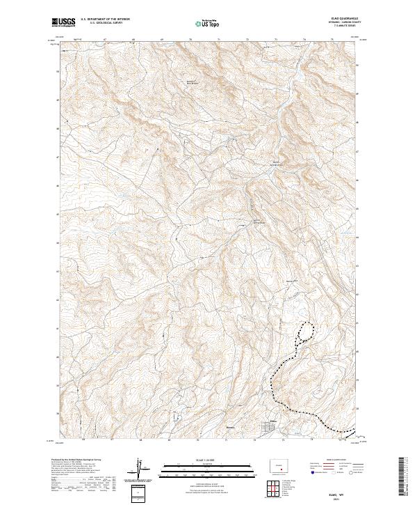
 1971 Elmo1975 Print · USGSThe settlement of Elmo is shown during its industrial peak in the early 1970s, surrounded by coal operations and heavy rail. Researchers can trace the path of the Arch Mineral Corporation Railroad and locate specific sites like the Tipple and Strip Mine.2 unique versions available
 - 1971 Map of Hanna, 1975 Print
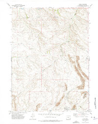
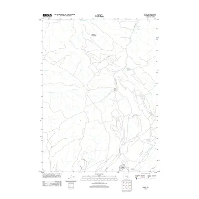
 1971 Hanna1975 Print · USGSIn the early seventies, the Carbon County coal town of Hanna sat at the heart of a high-desert industrial and rail landscape. Genealogists and historians can locate the Cemetery, the Mine Disaster Memorial, and the former site of Old Percy along the old rail grades.2 unique versions available
 - 1980 Map of Medicine Bow
 1980 Medicine Bow1980 Print · USGSCarbon County’s high plains and industrial corridors are captured here in the late twentieth century, centered on the coal-rich territory around Hanna. Genealogists and historians can trace the paths of the historic Overland Trail and the Union Pacific Railroad past settlements like Elmo and Fort Steele.
 - 1988 Map of Rawlins
 1988 Rawlins1988 Print · USGSSouthern Wyoming and the Colorado borderlands are detailed here in the late eighties, featuring the intersection of the historic Overland Trail and the Union Pacific. Researchers can trace old rail towns like Medicine Bow and Wamsutter or landmark peaks like Medicine Bow Peak.
 - 2012 Map of Elmo, 2012 Print
 2012 Elmo2012 Print · USGSCovers Hanna, including Carbon County, United States, and other nearby areas
 - 2012 Map of Hanna, 2012 Print
 2012 Hanna2012 Print · USGSCovers Hanna, including Carbon County, United States, and other nearby areas
 - 2015 Map of Elmo, 2015 Print
 2015 Elmo2015 Print · USGSCovers Hanna, including Carbon County, United States, and other nearby areas
 - 2015 Map of Hanna, 2015 Print
 2015 Hanna2015 Print · USGSCovers Hanna, including Carbon County, United States, and other nearby areas
 - 2017 Map of Elmo, 2017 Print
 2017 Elmo2017 Print · USGSCovers Hanna, including Carbon County, United States, and other nearby areas
 - 2017 Map of Hanna, 2017 Print
 2017 Hanna2017 Print · USGSCovers Hanna, including Carbon County, United States, and other nearby areas
 - 2021 Map of Elmo, 2021 Print
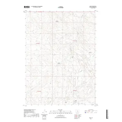
 2021 Elmo2021 Print · USGSThe communities of Hanna and Elmo are shown during a period of modern rural development in Carbon County. Researchers can trace local water systems and landmarks like Medicine Bow Breaks, Hanna Draw, and Barrel Spring.
 - 2021 Map of Hanna, 2021 Print
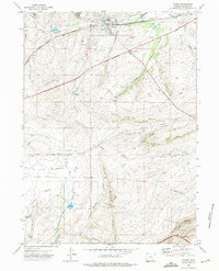
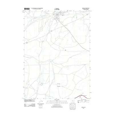
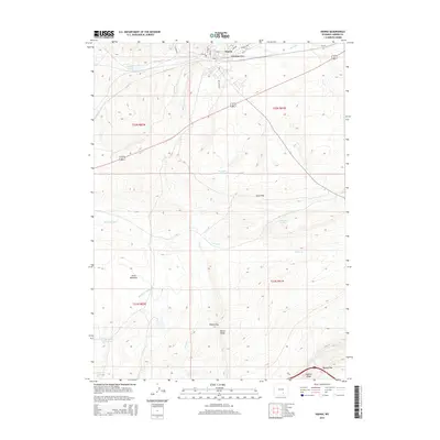
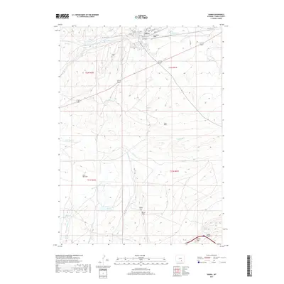
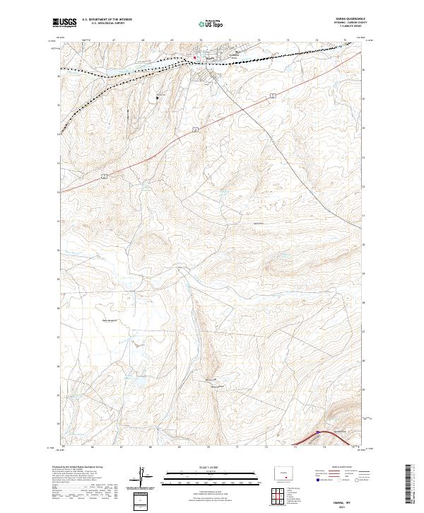 2021 Hanna2021 Print · USGSThe high-desert landscape of Carbon County is captured here in the early 2020s, centered on the community of Hanna. Researchers can trace the path of the Old Lincoln Hwy or locate local landmarks like Hanna Cem, Dana Meadows, and Wilson Ridge.
End of results
Showing maps 1-18 of 18
Top cities near Hanna
Top neighborhoods of Hanna
Frequently asked questions
- What are the different types of historical maps available for Hanna?
- What is the oldest map of Hanna?
- Where can I purchase historical maps of Hanna for my home or office?
- Where can I download high-res historical maps of Hanna?
- Are there historical topographic maps available for Hanna?
- Is there historical aerial imagery available for Hanna?
- Where are historical maps of Hanna sourced from?