Old Maps of Orpha, Wyoming for Academic Research
Study the evolution of Orpha with 6 high-resolution historic maps. Whether you're teaching, researching, or modeling changes in land use, these maps provide essential visual documentation of urban, environmental, and geographic change.
- Analyze long-term change: Track patterns in development, transportation, and natural features.
- Ideal for environmental or urban studies: Support academic projects with primary historical map data.
- Use in the classroom or lab: Educators and researchers rely on these maps to bring historical context to life.
These maps are a powerful tool for teaching, research, and visualizing how Orpha has changed over the decades.
Orpha, WY maps
(6)- 1949 Map of Orpha, 1959 Print
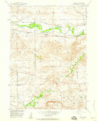 1949 Orpha1959 Print · USGSConverse County at the close of the 1940s reveals a landscape still deeply etched by pioneer history and the North Platte river-and-rail economy. Researchers can trace the Oregon Trail and Emigrant Trail, locate the La Prele Stage Station, and find local landmarks like Whiting Sch.2 unique versions available
 - 1950 Map of Orpha
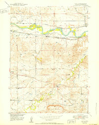 1950 Orpha1950 Print · USGSConverse County ranching and rail infrastructure are captured here in the post-war era as irrigation transformed the North Platte valley. Genealogists can locate family holdings like Hart Ranch and Burk Ranch or find vanished schoolhouses including Whiting Sch and Pleasant Valley Sch.
 - 1954 Map of Torrington, 1963 Print
 1954 Torrington1963 Print · USGSEastern Wyoming and the Nebraska borderlands are captured here during the mid-fifties, showing a landscape shaped by the Platte River and the Laramie Range. Researchers can trace deep history at the Fort Laramie National Historical Site, the Old Doty Ranch Site, and along the Old Fetterman Road.4 unique versions available
 - 1958 Map of Torrington
 1958 Torrington1958 Print · USGSEastern Wyoming and the Nebraska borderlands are captured in the late fifties, showcasing a landscape of high plains ranching and river-fed industry. Trace the historic paths of the Union Pacific railroad and find legacy sites like Fort Laramie and Sunrise.
 - 1981 Map of Douglas
 1981 Douglas1981 Print · USGSThe North Platte River corridor in the early eighties shows a landscape shaped by energy and iron. Genealogists and industrial historians can trace rail-side settlements like Glenrock, explore the Big Muddy Oil Field, and locate the old siding at Fetterman.
 - 2021 Map of Orpha, 2021 Print
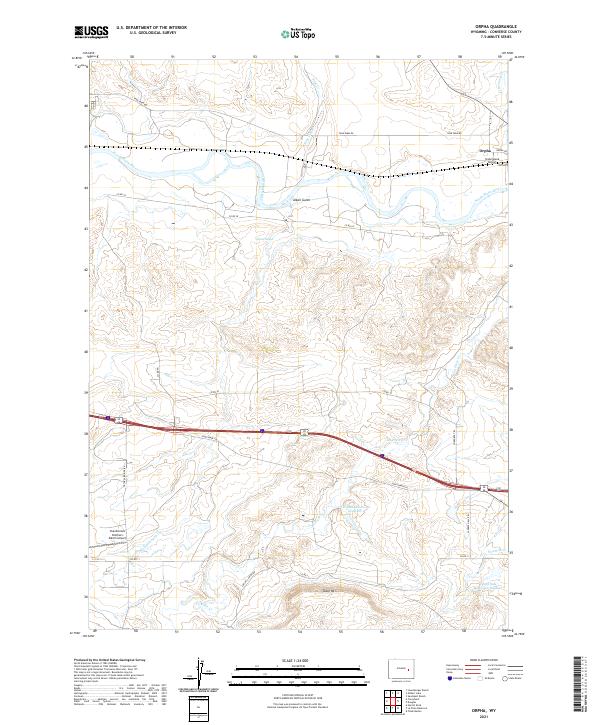 2021 Orpha2021 Print · USGSConverse County ranchlands and river valleys come into focus in this contemporary survey of the area near the North Platte. Researchers can trace the local landscape through landmarks like Orpha, the Chamberlain Brothers Ranch Airport, and Table Mtn.
End of results
Showing maps 1-6 of 6
Top cities near Orpha
Frequently asked questions
- What are the different types of historical maps available for Orpha?
- What is the oldest map of Orpha?
- Where can I purchase historical maps of Orpha for my home or office?
- Where can I download high-res historical maps of Orpha?
- Are there historical topographic maps available for Orpha?
- Is there historical aerial imagery available for Orpha?
- Where are historical maps of Orpha sourced from?