
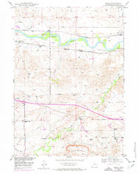
1949 Map of Orpha
USGS Topo · Published 1959About this map
The North Platte River winds through this Converse County landscape, a corridor defined by layers of Western transit and settlement history. The prominent path of the Oregon Trail and Emigrant Trail cuts across the terrain, marked by a lone Grave and the Oregon (Emigrant) Trail Marker near the La Prele Stage Station. This area preserves the footprint of early military and civilian passage, evidenced by the Old Fort Fetterman Reservation Boundary Lines stretching south from the river.
Find a feature on this map
33 named features on this map. Tap any name to fly to it.
Don’t see what you’re looking for? This feature index may not catch every label — zoom into the map to look around manually.
Map Details
Editions of this 1949 Orpha Map
2 editions found
Other maps of this area

1949 · Sundquist Ranch
USGS Topo · 1:24,000

1949 · Careyhurst
USGS Topo · 1:24,000

1949 · Gilbert Lake
USGS Topo · 1:24,000

1949 · Douglas
USGS Topo · 1:24,000

1949 · Leuenberger Ranch
USGS Topo · 1:24,000

1949 · Chalk Buttes
USGS Topo · 1:24,000

1950 · Careyhurst
USGS Topo · 1:24,000

1950 · Gilbert Lake
USGS Topo · 1:24,000

1950 · Leuenberger Ranch
USGS Topo · 1:24,000

1950 · Douglas
USGS Topo · 1:24,000