2000s (21st Century) Maps of Buffalo, Wyoming
Explore 2 historic maps of Buffalo from the 2000s (21st Century). These maps offer a rare glimpse into what life looked like during the 2000s — showing old roads, neighborhoods, homes, and landmarks that have changed or disappeared over time.
Whether you're researching your family's past, planning a metal detecting trip, or studying how Buffalo's landscape evolved across the 2000s, these high-resolution maps are a powerful tool for exploring the history of this region.
- Focus on a specific era: All maps on this page are from the 2000s, giving you a focused view of this time period.
- See what’s changed: Compare century-old streets, trails, and buildings to today's modern landscape using overlays and satellite layers.
- Research with precision: Use these maps for genealogy, historical research, land use analysis, or educational projects.
- View, download, or print: Maps are fully viewable online in high resolution, and can be downloaded or printed for your own records.
Start exploring Buffalo's history through authentic maps from the 2000s. This is your window into the past.
Buffalo, WY maps
(2)- 2021 Map of North Ridge, 2021 Print
 2021 North Ridge2021 Print · USGSJohnson County high country meets the western edge of Buffalo in the early 2020s. Trace historical water rights and mountain access via Moeller Ditch Number 1, Eagle Ditch, and the Grommund Point Trl.
 - 2021 Map of Buffalo, 2021 Print
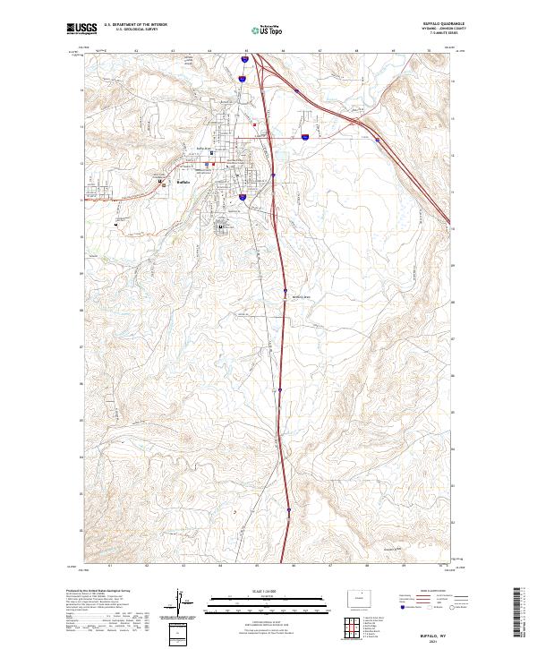 2021 Buffalo2021 Print · USGSBuffalo and its surrounding Johnson County ranchlands appear here in the early twenty-first century, showing the enduring legacy of frontier water rights. Researchers can trace the path of the Johnson County-Ditch and locate the Fort McKinney Post Cem near Clear Cr.
End of results
Showing maps 1-2 of 2
Frequently asked questions
- What are the different types of historical maps available for Buffalo?
- What is the oldest map of Buffalo?
- Where can I purchase historical maps of Buffalo for my home or office?
- Where can I download high-res historical maps of Buffalo?
- Are there historical topographic maps available for Buffalo?
- Is there historical aerial imagery available for Buffalo?
- Where are historical maps of Buffalo sourced from?