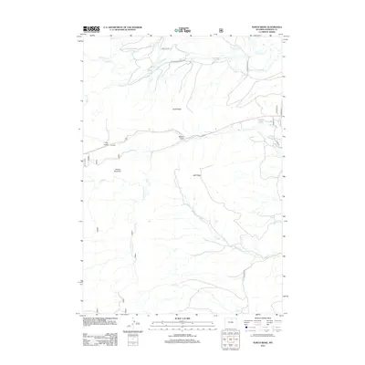
2012 Map of North Ridge
USGS Topo · Published 2012About this map
North Ridge and the surrounding high country of Johnson County are defined by a complex network of water management features essential to this part of Wyoming. In this 2012 survey, the landscape is etched with numerous irrigation channels including Eagle Ditch, Moeller Ditch, and the Johnson County Ditch, which redirect water from natural sources like Clear Cr and French Cr. These man-made waterways illustrate the long-standing agricultural and ranching priorities of the region, where water rights and distribution have historically dictated the viability of the land.
Find a feature on this map
29 named features on this map. Tap any name to fly to it.
Don’t see what you’re looking for? This feature index may not catch every label — zoom into the map to look around manually.
Map Details
Editions of this 2012 North Ridge Map
This is the sole edition of this map. No revisions or reprints were ever made.
Other maps of this area

1900 · Fort McKinney
USGS Topo · 1:125,000

1903 · Fort McKinney
USGS Topo · 1:125,000

1955 · Sheridan
USGS Topo · 1:250,000

1958 · Sheridan
USGS Topo · 1:250,000

1962 · Sheridan
USGS Topo · 1:250,000

1967 · Lake De Smet West
USGS Topo · 1:24,000

1967 · Caribou Creek
USGS Topo · 1:24,000
1967 · Klondike Ranch
USGS Topo · 1:24,000
1967 · Hunter Mesa
USGS Topo · 1:24,000
1967 · Stone Mountain
USGS Topo · 1:24,000