
1967 Map of Caribou Creek
USGS Topo · Published 1971About this map
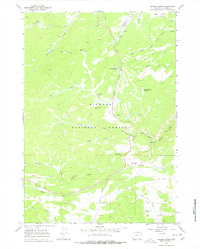
Big Horn National Forest dominates this mountain landscape, where drainage systems for the North Fork Crazy Woman Creek and Muddy Creek converge. The 1967 topography reveals a working forest infrastructure, featuring the Muddy Creek Guard Station and the State Highway Maintenance Camp located along the modern road corridor. Local industry and education are represented by the Hanson Sawmill and the Caribou Sch, serving the dispersed population and seasonal camps of this high-elevation region.
Find a feature on this map
35 named features on this map. Tap any name to fly to it.
Don’t see what you’re looking for? This feature index may not catch every label — zoom into the map to look around manually.
Map Details
Editions of this 1967 Caribou Creek Map
2 editions found
Other maps of this area

1899 · Cloud peak
USGS Topo · 1:125,000

1900 · Fort McKinney
USGS Topo · 1:125,000

1901 · Cloud Peak
USGS Topo · 1:125,000

1903 · Fort McKinney
USGS Topo · 1:125,000

1955 · Sheridan
USGS Topo · 1:250,000

1958 · Sheridan
USGS Topo · 1:250,000

1962 · Sheridan
USGS Topo · 1:250,000
1967 · Hazelton
USGS Topo · 1:24,000
1967 · Hazelton Peak
USGS Topo · 1:24,000
1967 · Klondike Ranch
USGS Topo · 1:24,000