Old Maps of Altvan, Wyoming for Metal Detecting
Plan your next treasure hunt with 7 historic maps of Altvan. Find old homesites, ghost towns, trails, and gathering spots that may be lost to time — perfect for identifying promising metal detecting locations.
- Locate forgotten sites: Uncover places like long-lost settlements, abandoned rail lines, or gathering spots.
- Plan better hunts: Use map overlays combined with LiDAR or satellite views to narrow in on historically rich areas.
- Made for detectorists: Thousands of hobbyists use these maps to discover relics, coins, and hidden history.
Use these historic maps to boost your research and find new opportunities beneath the surface of Altvan.
Altvan, WY maps
(7)- 1911 Map of Cheyenne, 1961 Print
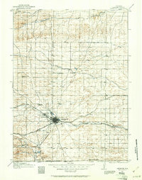 1911 Cheyenne1961 Print · USGSCheyenne was a bustling rail and military center in the years before the Great War. Genealogists and historians can trace the footprint of Fort D.A. Russell and find early rural sites like Campstool and Paola.
 - 1914 Map of Cheyenne
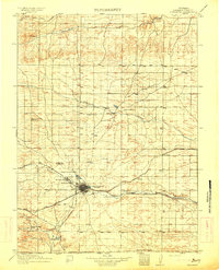 1914 Cheyenne1914 Print · USGSCheyenne stands at the crossroads of three major railroads in the years before the Great War. Researchers can trace the layout of the Fort D.A. Russell Military Reservation and find local landmarks like Ridley School and Campstool.3 unique versions available
 - 1954 Map of Cheyenne, 1963 Print
 1954 Cheyenne1963 Print · USGSSoutheastern Wyoming's high plains and the capital city's mid-century expansion are documented here during the early Cold War. Genealogists and historians can trace rail-aligned settlements like Pine Bluffs and Hillsdale, or explore landmarks like the Ames Monument and Francis E. Warren Air Force Base.3 unique versions available
 - 1958 Map of Cheyenne
 1958 Cheyenne1958 Print · USGSSoutheast Wyoming and the Nebraska border appear in the late 1950s as a hub of military defense and rail commerce. Genealogists can trace the Union Pacific through Cheyenne or locate the Horse Creek Oil Field and the State Capitol.2 unique versions available
 - 1963 Map of Altvan, 1978 Print
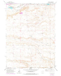 1963 Altvan1978 Print · USGSThe Wyoming and Colorado borderlands in the early sixties reveal a complex landscape of ranching and water rights. Researchers can trace historical property boundaries and livestock infrastructure through Altvan and along the Burlington Northern line, identifying named landmarks like the Century Windmill and Stewart DITCH.
 - 1981 Map of Cheyenne
 1981 Cheyenne1981 Print · USGSCheyenne and the surrounding high plains are captured here in the early eighties, showcasing the intersection of major rail lines and interstate highways. Genealogists and historians can trace the development of outlying ranching communities like Carpenter, Arcola, and the border town of Pine Bluffs.2 unique versions available
 - 2021 Map of Altvan, 2021 Print
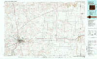
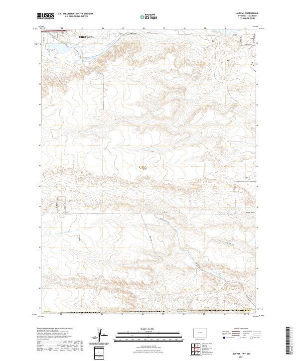 2021 Altvan2021 Print · USGSThe high plains south of Cheyenne at the start of the 2020s reveal a landscape deeply shaped by historic irrigation and ranching. Trace the path of the Wyoming Hereford Ranch Ditch Number 1 or find landmarks like Altvan and Bull Canyon.
End of results
Showing maps 1-7 of 7
Top cities near Altvan
- Cheyenne historical maps
- Ranchettes historical maps
- South Greeley historical maps
- Fox Farm–College historical maps
- Warren Air Force Base historical maps
- Hillsdale historical maps
Frequently asked questions
- What are the different types of historical maps available for Altvan?
- What is the oldest map of Altvan?
- Where can I purchase historical maps of Altvan for my home or office?
- Where can I download high-res historical maps of Altvan?
- Are there historical topographic maps available for Altvan?
- Is there historical aerial imagery available for Altvan?
- Where are historical maps of Altvan sourced from?