Old Maps of Badger Basin, Wyoming for Academic Research
Study the evolution of Badger Basin with 7 high-resolution historic maps. Whether you're teaching, researching, or modeling changes in land use, these maps provide essential visual documentation of urban, environmental, and geographic change.
- Analyze long-term change: Track patterns in development, transportation, and natural features.
- Ideal for environmental or urban studies: Support academic projects with primary historical map data.
- Use in the classroom or lab: Educators and researchers rely on these maps to bring historical context to life.
These maps are a powerful tool for teaching, research, and visualizing how Badger Basin has changed over the decades.
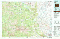
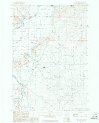
Badger Basin, WY maps
(7)- 1950 Map of Clark, 1952 Print
 1950 Clark1952 Print · USGSNorthern Wyoming ranching and early petroleum development meet here at the start of the 1950s. Researchers can trace family homesteads like Johnson Ranch and locate local landmarks including Clark Sch and the Clark Cem.3 unique versions available
 - 1955 Map of Cody, 1969 Print
 1955 Cody1969 Print · USGSThe Bighorn Basin and Absaroka Range meet in the mid-fifties, capturing a landscape defined by mountain wilderness and burgeoning oil fields. Trace family roots in Cody or Meeteetse, and locate industrial landmarks like the Elk Basin Oil and Gas Field and the Chicago Burlington and Quincy RR.2 unique versions available
 - 1958 Map of Cody
 1958 Cody1958 Print · USGSNorthwestern Wyoming at the peak of the mid-century energy and ranching boom shows a land of high peaks and oil basins. Researchers can trace the Chicago Burlington and Quincy rail lines through Greybull or locate the sprawling Elk Basin Oil and Gas Field.
 - 1962 Map of Cody
 1962 Cody1962 Print · USGSBig Horn Basin energy and agriculture define this mid-century look at Wyoming’s northern frontier. Local historians can trace the irrigation and rail networks connecting Cody and Powell to major energy sites like the Oregon Basin Oil Field.
 - 1980 Map of Cody, 1982 Print
 1980 Cody1982 Print · USGSThe Cody region in the early 1980s reveals a rugged wilderness of the Shoshone National Forest meeting the plains. Researchers can trace the Burlington Northern rail line and locate landmarks like Painter Mine and Buffalo Bill Reservoir.3 unique versions available
 - 1987 Map of Badger Basin
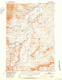
 1987 Badger Basin1987 Print · USGSPark County, Wyoming, near the Montana line, is shown in the late 1980s as a hub of river-valley irrigation and industrial activity. Researchers can trace the water-management systems of the Clarks Fork Yellowstone River, including the Sirrine DITCH and several Aqueduct segments.
 - 2021 Map of Badger Basin, 2021 Print
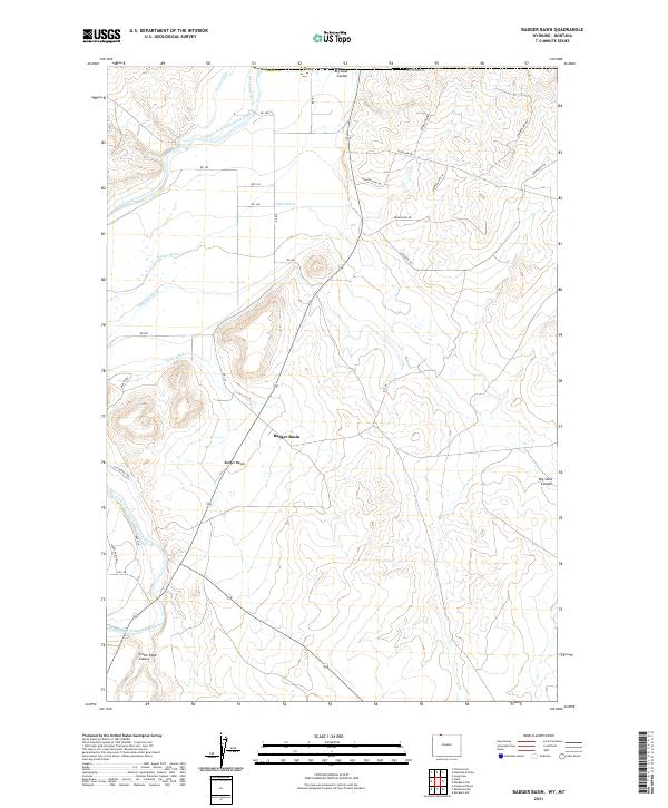 2021 Badger Basin2021 Print · USGSIn the northwestern corner of Wyoming near the Montana border, this modern landscape reveals a complex history of desert irrigation. Researchers can trace the path of the Clarks Fork Yellowstone River and historic water works like the Interstate Ditch and State Ditch.
End of results
Showing maps 1-7 of 7
Frequently asked questions
- What are the different types of historical maps available for Badger Basin?
- What is the oldest map of Badger Basin?
- Where can I purchase historical maps of Badger Basin for my home or office?
- Where can I download high-res historical maps of Badger Basin?
- Are there historical topographic maps available for Badger Basin?
- Is there historical aerial imagery available for Badger Basin?
- Where are historical maps of Badger Basin sourced from?