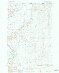
1987 Map of Badger Basin
USGS Topo · Published 1987About this map
The Badger Basin landscape at the Montana-Wyoming border is defined by a complex network of industrial and irrigation infrastructure along the Clarks Fork Yellowstone River. In the late 1980s, this area supported significant resource extraction and agricultural water management, evidenced by the presence of a Pumping Sta and an Aboveground Pipeline crossing the basin.
Find a feature on this map
17 named features on this map. Tap any name to fly to it.
Don’t see what you’re looking for? This feature index may not catch every label — zoom into the map to look around manually.
Map Details
Editions of this 1987 Badger Basin Map
This is the sole edition of this map. No revisions or reprints were ever made.
Other maps of this area

1944 · Red Lodge
USGS Topo · 1:62,500

1950 · Clark
USGS Topo · 1:62,500

1954 · Billings
USGS Topo · 1:250,000

1955 · Cody
USGS Topo · 1:250,000

1957 · Billings
USGS Topo · 1:250,000

1958 · Billings
USGS Topo · 1:250,000

1958 · Cody
USGS Topo · 1:250,000

1962 · Cody
USGS Topo · 1:250,000

1966 · Elk Basin SW
USGS Topo · 1:24,000

1966 · Elk Basin NW
USGS Topo · 1:24,000