Old Maps of Carbon County, Montana
Explore 406 old maps of Carbon County, spanning from 1892 to today. These high-resolution historic maps reveal how streets, neighborhoods, landmarks, and natural features evolved over time — perfect for genealogy, metal detecting, research, and local history exploration.
What you can do with these maps:
- See how Carbon County changed over time: Compare historical maps to modern-day views to trace roads, homesites, rail lines & more.
- View detailed metadata: Each map includes creators, publishers, year, scale, and archive source.
- Overlay maps with satellite & LiDAR: Visualize the past alongside modern tools to explore terrain & human change.
- Trusted historical sources: Maps sourced from the USGS, Library of Congress, and other archives.
- Access maps your way: View online, download high-res files, or order prints for personal or research use.
Start exploring old maps of Carbon County to uncover forgotten places, hidden landmarks, and the deep history beneath your feet.
Carbon County, MT maps
(406)- 1892 Map of Stillwater
 1892 Stillwater1892 Print · USGSThe Yellowstone valley in the late nineteenth century was a corridor of rapid transition as the railroad moved westward alongside the Crow Indian Reservation. Researchers can trace early river crossings and pioneer settlements such as Merrill, Stillwater, and the Ford at Youngs Point.4 unique versions available
 - 1898 Map of Granite Mountain District
 1898 Granite Mountain District1898 Print · USGSThe Beartooth Range appears here in the late nineteenth century during a specialized survey for regional coal and electric companies. Researchers can trace early mountain pathways through Goose Lake Pass and locate major summits like Granite Peak and Mt Dewey.
 - 1932 Map of Red Lodge No 2
 1932 Red Lodge No 21932 Print · USGSCarbon County ranching country is documented in detail during the early 1930s, showing a landscape organized around mountain streams and rural post offices. Genealogists can locate family-named landmarks and country schools like Inderland Sch, Jackson Sch, and the community at Fishtail.
 - 1932 Map of Red Lodge No 1
 1932 Red Lodge No 11932 Print · USGSCarbon County ranching and early energy infrastructure are on display in this early 1930s survey of the northern Beartooth foothills. Genealogists and historians can trace the rail corridor between Roberts and Boyd or locate industrial sites like the Gas Control Sta.
 - 1932 Map of Nye No 1
 1932 Nye No 11932 Print · USGSStillwater and Carbon counties appear here in the early 1930s, as ranching settlements met the mountain wilderness. Genealogists and local historians can trace the foundations of Fishtail, locate the Dean PO, and follow trails into the Beartooth National Forest.
 - 1944 Map of Red Lodge, 1946 Print
 1944 Red Lodge1946 Print · USGSCarbon County’s coal and ranching economy is captured here in the mid-1940s, from the railhead at Red Lodge to the banks of the Clarks Fork Yellowstone River. Genealogists and industrial historians can trace the operations of the Smith Mine, the Ohio Oil Co Camp, and the rural Clear Creek Sch.3 unique versions available
 - 1950 Map of Clark, 1952 Print
 1950 Clark1952 Print · USGSNorthern Wyoming ranching and early petroleum development meet here at the start of the 1950s. Researchers can trace family homesteads like Johnson Ranch and locate local landmarks including Clark Sch and the Clark Cem.3 unique versions available
 - 1954 Map of Billings, 1963 Print
 1954 Billings1963 Print · USGSThe Yellowstone valley during the mid-fifties shows a landscape of thriving rail towns and high-mountain outposts. Genealogists and historians can trace old homesteads and mining routes near Red Lodge, Bearcreek, and along the Bighorn River.4 unique versions available
 - 1955 Map of Cody, 1969 Print
 1955 Cody1969 Print · USGSThe Bighorn Basin and Absaroka Range meet in the mid-fifties, capturing a landscape defined by mountain wilderness and burgeoning oil fields. Trace family roots in Cody or Meeteetse, and locate industrial landmarks like the Elk Basin Oil and Gas Field and the Chicago Burlington and Quincy RR.2 unique versions available
 - 1956 Map of Emerald Lake, 1957 Print
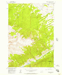 1956 Emerald Lake1957 Print · USGSThe Stillwater and Carbon County borderlands are captured here in the mid-fifties as high-alpine wilderness met early ranching life. Genealogists and historians can trace family-named sites like the Bedford School, Hash Ranch, and Bedford Ranch at the forest's edge.3 unique versions available
 - 1956 Map of Fishtail, 1957 Print
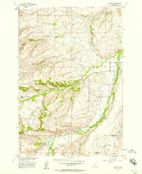 1956 Fishtail1957 Print · USGSFishtail and the surrounding ranchlands are documented here in the mid-fifties at the edge of the Beartooth foothills. Researchers can trace the complex irrigation network of Magee Ditch and West Rosebud Ditch or locate the Twin Butte Sch.2 unique versions available
 - 1956 Map of Bridger, 1957 Print
 1956 Bridger1957 Print · USGSThe Clarks Fork Yellowstone River valley was a busy corridor of rails and ranches in the mid-fifties. Genealogists and historians can trace family properties like Simpson Ranch or locate the Cherry Springs Sch (Aband) and Bostic Cem.2 unique versions available
 - 1956 Map of Roscoe, 1957 Print
 1956 Roscoe1957 Print · USGSCarbon County ranching culture is frozen in time during the mid-fifties as family homesteads and irrigation systems networked the foothills. Genealogists can trace specific legacy holdings like the Youngstrom Ranch, Tony Cem, and the cluster of Boggio family properties.3 unique versions available
 - 1956 Map of Shane Ridge, 1957 Print
 1956 Shane Ridge1957 Print · USGSThe Stillwater County river valley and surrounding uplands are captured here in the mid-1950s. Genealogists and historians can trace rural schoolhouse locations like Standard Sch and Shane Creek Sch or follow the path of the Northern Pacific.2 unique versions available
 - 1956 Map of Alpine, 1957 Print
 1956 Alpine1957 Print · USGSThe Beartooth Range at the mid-century is captured here in immense detail, showing the glacial peaks and alpine lakes of the Montana-Wyoming border. Trace high-altitude landmarks like the Mystic Lake Hydroelectric Plant, the settlement at Alpine, and the rugged paths of the Arch Creek Trail.3 unique versions available
 - 1956 Map of Mackay Ranch, 1957 Print
 1956 Mackay Ranch1957 Print · USGSThe high ranching country of south-central Montana is captured here in the mid-1950s, showing a landscape defined by water rights and family homesteads. Genealogists and historians can trace legacy properties like Mackay Ranch, Reeves Ranch, and the T O Bar Ranch.3 unique versions available
 - 1956 Map of Roscoe NW, 1957 Print
 1956 Roscoe NW1957 Print · USGSStillwater and Carbon counties were defined by complex irrigation networks in the mid-1950s. Genealogists and local historians can trace family-named water works like the Tuttle Luther Ditch and find landmarks like the Reverend Madison Historical Monument.2 unique versions available
 - 1956 Map of Silesia, 1958 Print
 1956 Silesia1958 Print · USGSSilesia and Rockvale served as vital hubs for the valley's irrigation and rail networks during the mid-fifties. Genealogists and historians can trace old homestead sites near White Horse Sch or locate the junction of the Northern Pacific and Chicago Burlington and Quincy railroads.
 - 1956 Map of Roscoe NE, 1958 Print
 1956 Roscoe NE1958 Print · USGSRanching life in Stillwater and Carbon counties during the mid-fifties centered on family-named lands and rural schools. You can trace established homesteads like the John Korpela Ranch and Maki Ranch alongside the Ramsland Ditch irrigation network.3 unique versions available
 - 1956 Map of Fromberg, 1958 Print
 1956 Fromberg1958 Print · USGSThe Clark Fork and Rock Creek valleys of southern Montana are mapped here in the mid-fifties during the height of the regional irrigation and rail era. Genealogists and historians can trace the foundations of Joliet and Fromberg, locating the Joliet Cem and the complex system of the Carbon Canal.2 unique versions available
 - 1956 Map of Rapids, 1958 Print
 1956 Rapids1958 Print · USGSThe Yellowstone River valley and the Northern Pacific railroad define this mid-century landscape on the border of Carbon and Stillwater counties. Researchers can trace rural life through landmarks like Cow Creek Sch, the siding at Rapids, and irrigation systems like Cove Ditch.2 unique versions available
 - 1956 Map of Roberts, 1958 Print
 1956 Roberts1958 Print · USGSCarbon County ranching and rail infrastructure are captured here in the mid-1950s as irrigation ditches transformed the benches between the creek valleys. Genealogists and local historians can locate specific community landmarks like Finnish Hall, the Fox Sch, and the St Thomas Ch.
 - 1956 Map of Mount Maurice, 1958 Print
 1956 Mount Maurice1958 Print · USGSRed Lodge sits at the edge of the Beartooth Front in the mid-1950s, a hub for high-country research and recreation. Genealogists and historians can trace local landmarks like Draper Sch, the Red Lodge Cemetery, and Camp Senia along the mountain foothills.4 unique versions available
 - 1956 Map of Laurel, 1958 Print
 1956 Laurel1958 Print · USGSThe Yellowstone River valley is captured here in the mid-fifties, showing the intersection of heavy industry and historic trails. Researchers can trace the massive Oil Refinery, the Northern Pacific line, and landmarks like St Anthonys Ch or the Buffalo Trail.2 unique versions available
 - 1956 Map of Castagne, 1958 Print
 1956 Castagne1958 Print · USGSCarbon County ranching and irrigation are captured here during the mid-1950s as the Missouri River Basin development progressed. Genealogists and historians can trace family landmarks like the John Henry Cem, Hogan Sch, and the small settlement of Castagne.2 unique versions available
Showing maps 1-25 of 406
Top cities of Carbon County
- Red Lodge historical maps
- Bridger historical maps
- Joliet historical maps
- Fromberg historical maps
- Bearcreek historical maps
Frequently asked questions
- What are the different types of historical maps available for Carbon County?
- What is the oldest map of Carbon County?
- Where can I purchase historical maps of Carbon County for my home or office?
- Where can I download high-res historical maps of Carbon County?
- Are there historical topographic maps available for Carbon County?
- Is there historical aerial imagery available for Carbon County?
- Where are historical maps of Carbon County sourced from?