1960s Maps of Carbon County, Montana
Explore 32 historic maps of Carbon County from the 1960s. These maps offer a rare glimpse into what life looked like during the 1960s — showing old roads, neighborhoods, homes, and landmarks that have changed or disappeared over time.
Whether you're researching your family's past, planning a metal detecting trip, or studying how Carbon County's landscape evolved across the 1960s, these high-resolution maps are a powerful tool for exploring the history of this region.
- Focus on a specific era: All maps on this page are from the 1960s, giving you a focused view of this time period.
- See what’s changed: Compare century-old streets, trails, and buildings to today's modern landscape using overlays and satellite layers.
- Research with precision: Use these maps for genealogy, historical research, land use analysis, or educational projects.
- View, download, or print: Maps are fully viewable online in high resolution, and can be downloaded or printed for your own records.
Start exploring Carbon County's history through authentic maps from the 1960s. This is your window into the past.
Carbon County, MT maps
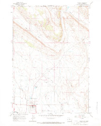
(32)- 1962 Map of Cody
 1962 Cody1962 Print · USGSBig Horn Basin energy and agriculture define this mid-century look at Wyoming’s northern frontier. Local historians can trace the irrigation and rail networks connecting Cody and Powell to major energy sites like the Oregon Basin Oil Field.
 - 1964 Map of Big Ice Cave, 1967 Print
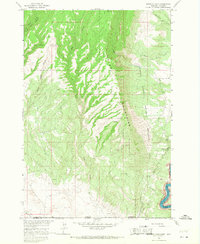
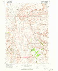
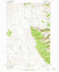
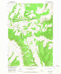 1964 Big Ice Cave1967 Print · USGSThe Pryor Mountains during the mid-1960s are shown in detail, documenting the high-country ranching and geology of the Montana-Wyoming border. Trace the location of family landmarks like Greenough Ranch and geological curiosities like Big Ice Cave and Crater Ice Cave.2 unique versions available
 - 1964 Map of Red Pryor Mountain, 1967 Print
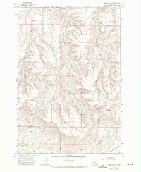
 1964 Red Pryor Mountain1967 Print · USGSThe Pryor Mountains of Montana were a hub for remote mining and ranching in the mid-1960s, straddling the high border of the Missouri River Basin. Genealogists and researchers can trace the locations of the Tillett Ranch, the Old Glory Mine, and the notable Red Pryor Ice Cave.
 - 1964 Map of Little Finger Ridge, 1967 Print
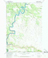
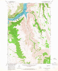 1964 Little Finger Ridge1967 Print · USGSBig Horn County is captured here in the mid-1960s as the recently filled Yellowtail Reservoir reshaped the canyon floor. Researchers can trace the Crow Indian Reservation Boundary across landforms like The Buffalo Pasture and the Natural Bridge.
 - 1964 Map of Dead Indian Hill, 1968 Print
 1964 Dead Indian Hill1968 Print · USGSThe Bighorn River canyons of Montana are captured here in the mid-1960s as the new reservoir began to fill the gorge. Researchers can trace family-named landmarks like Petes Spring, locate an isolated grave, and see the extent of the Crow Indian Reservation Boundary.
 - 1964 Map of Sykes Spring, 1968 Print
 1964 Sykes Spring1968 Print · USGSBig Horn County at the Montana-Wyoming border is captured during the 1960s as the new reservoir began to fill the canyon. Researchers can trace the early development of Bighorn Canyon National Recreation Area and find traditional landmarks like Sykes Spring and Britton Spring.2 unique versions available
 - 1964 Map of East Pryor Mountain, 1968 Print
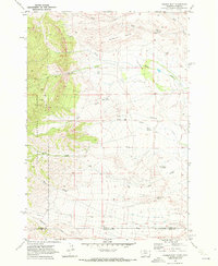
 1964 East Pryor Mountain1968 Print · USGSThe East Pryor Mountains and the border of the Crow Indian Reservation are captured here in the mid-1960s. Researchers can locate remote high-country landmarks like Buffalo Jump, several Prospect pits, and geological curiosities including Ice Cave and Little Ice Cave.3 unique versions available
 - 1964 Map of Mystery Cave, 1968 Print
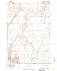
 1964 Mystery Cave1968 Print · USGSThe Pryor Mountains straddle the Montana-Wyoming border in the mid-1960s, showing a rugged landscape of caves and canyons. Researchers can locate remote features like Mystery Cave, Sykes Cave, and the waters of the Yellowtail Reservoir.4 unique versions available
 - 1964 Map of Natural Trap Cave, 1968 Print
 1964 Natural Trap Cave1968 Print · USGSThe Big Horn County landscape undergoes a dramatic shift in the 1960s as the river is dammed to create Yellowtail Reservoir. Genealogists and historians can locate Kane Cem and trace old resource sites like Titan Mine and the Glory Hole.2 unique versions available
 - 1964 Map of Hillsboro, 1968 Print
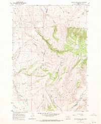
 1964 Hillsboro1968 Print · USGSBig Horn County in the mid-sixties shows the deep canyons and new shorelines created by the Yellowtail Reservoir. Genealogists and historians can trace the Hillsboro settlement and locate distinct landmarks like Bighorn Caverns, Horse Thief Cave, and the Natural Corrals.
 - 1966 Map of Frannie, 1969 Print
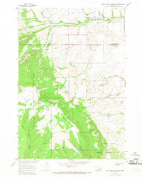
 1966 Frannie1969 Print · USGSThe northern Bighorn Basin comes into sharp focus in the 1960s as a hub of irrigation and rail transport. Genealogists and local historians can trace the development of Deaver and Frannie along the Chicago Burlington and Quincy railroad line.
 - 1966 Map of Elk Basin, 1969 Print
 1966 Elk Basin1969 Print · USGSThe northern Wyoming oil frontier is captured here in the mid-1960s, showing a landscape defined by energy production. Researchers can trace the extensive infrastructure of the Elk Basin Oil Field and the Sulphur Plant, or locate the original site of the Powell Municipal Airport.2 unique versions available
 - 1966 Map of Cowley, 1969 Print
 1966 Cowley1969 Print · USGSCowley and its surrounding agricultural lands are captured in the mid-1960s just south of the Montana border. Researchers can trace the Sidon Canal irrigation network and locate community landmarks like the Cowley Cem and Rodeo Ground.3 unique versions available
 - 1966 Map of Elk Basin NW, 1969 Print
 1966 Elk Basin NW1969 Print · USGSThe high plains of the Wyoming-Montana border are captured here during a period of intense energy development. Trace the industrial footprint of the Silver Tip Oil Field and topographic landmarks like Polecat Bench and Big Sand Coulee.2 unique versions available
 - 1966 Map of Deaver Reservoir, 1969 Print
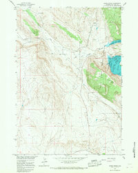
 1966 Deaver Reservoir1969 Print · USGSThe Montana-Wyoming border was a hub of energy and irrigation in the mid-sixties, dominated by the rise of Polecat Bench. Researchers can trace the industrial footprint of the Frannie Oil Field, the rail lines of the Chicago Burlington and Quincy, and the waters of Deaver Reservoir.2 unique versions available
 - 1967 Map of Section House Draw, 1971 Print
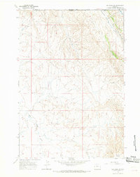
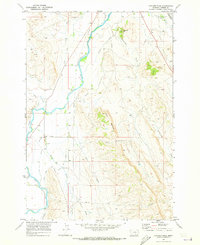
 1967 Section House Draw1971 Print · USGSBig Horn and Carbon Counties are captured here in the late sixties, showing the intersection of reservation lands and the high mountain front. Researchers can trace the Crow Indian Reservation Boundary as it crosses Section House Draw and the steep walls of Black Canyon.
 - 1967 Map of Bluewater, 1971 Print
 1967 Bluewater1971 Print · USGSCarbon County, Montana, was a landscape of managed water and remote wells during the late sixties. Researchers can trace the irrigation systems around the Bluewater Fish Hatchery and locate family-named sites like Bachelder Canyon and the Ruckavina Well No 1.2 unique versions available
 - 1967 Map of Mossmain SW, 1971 Print
 1967 Mossmain SW1971 Print · USGSSouth-central Montana in the late sixties reveals an active landscape of energy extraction along the county line. Researchers can trace the extent of the Mosser Dome Oil Field and follow the northern edge of the Crow Indian Res Bdy.
 - 1967 Map of Pryor NW, 1971 Print
 1967 Pryor NW1971 Print · USGSCarbon County ranchlands meet the reservation line in the late sixties, showing a landscape defined by water and territory. Researchers can trace the path of the Crow Indian Reservation Boundary and drainage patterns of Wolf Creek and Willow Creek.
 - 1969 Map of Laurel, 1970 Print
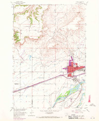 1969 Laurel1970 Print · USGSThe confluence of the Yellowstone and Clarks Fork rivers defines this Montana landscape during the late sixties. Genealogists and researchers can trace the growth of Laurel through its churches, schools like Trewin Sch, and the extensive Burlington Northern rail yards.
 - 1969 Map of Tolman Flat, 1972 Print
 1969 Tolman Flat1972 Print · USGSThe Montana-Wyoming border country is captured here in the late sixties, where the high mesas of Dilworth Bench overlook a sparse ranching landscape. Trace the geography of early pioneers and miners through the Tolman Cem, Grove Creek Mine, and remote water sources like Three Corner Spring.2 unique versions available
 - 1969 Map of Warren, 1972 Print
 1969 Warren1972 Print · USGSCrossing the Montana-Wyoming border in the late sixties, this survey shows the arid landscape of Carbon County during a period of rising industrial activity. Researchers can trace the path of the Burlington Northern railroad and locate old resource sites like the Gravel Pit or Oil Well near Warren.
 - 1969 Map of Hollenbeck Draw, 1972 Print
 1969 Hollenbeck Draw1972 Print · USGSThe Montana and Wyoming borderlands are defined here in the late sixties by the lifeblood of the Clarks Fork Yellowstone River. Researchers can trace early irrigation networks like Silver Tip Ditch and locate family history at Belfry Cem or Chance Cem.2 unique versions available
 - 1969 Map of Bowler, 1972 Print
 1969 Bowler1972 Print · USGSThe Montana borderlands near the Crow Indian Reservation come into focus during the late sixties. Genealogists and historians can trace the settlement at Bowler, locate the Bowler Cem, and follow old routes like Bent Trail and Miller Trail.2 unique versions available
 - 1969 Map of Hatcher Pass, 1973 Print
 1969 Hatcher Pass1973 Print · USGSCarbon County agriculture and transit are on display here in the late sixties, where the river valley meets the upland breaks. Researchers can trace the extensive irrigation network including the Golden Canal and locate landmarks like Hatcher Pass and the Burlington Northern line.2 unique versions available
Showing maps 1-25 of 32
Top cities of Carbon County
- Red Lodge historical maps
- Bridger historical maps
- Joliet historical maps
- Fromberg historical maps
- Bearcreek historical maps
Frequently asked questions
- What are the different types of historical maps available for Carbon County?
- What is the oldest map of Carbon County?
- Where can I purchase historical maps of Carbon County for my home or office?
- Where can I download high-res historical maps of Carbon County?
- Are there historical topographic maps available for Carbon County?
- Is there historical aerial imagery available for Carbon County?
- Where are historical maps of Carbon County sourced from?