
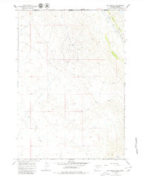
1966 Map of Elk Basin NW
USGS Topo · Published 1969About this map
The Silver Tip Oil Field dominates this high-plains landscape along the border of Montana and Wyoming. Mapped in the mid-1960s, the terrain is defined by a dense network of unimproved roads and numerous Drill Holes, signaling the intense energy exploration of the era. The land slopes sharply from the prominent Polecat Bench in the southeast, where seasonal drainages like Silver Tip Creek and the Big Sand Coulee have carved intricate coulees through the arid soil.
Find a feature on this map
7 named features on this map. Tap any name to fly to it.
Don’t see what you’re looking for? This feature index may not catch every label — zoom into the map to look around manually.
Map Details
Editions of this 1966 Elk Basin NW Map
2 editions found
Other maps of this area

1944 · Red Lodge
USGS Topo · 1:62,500

1950 · Clark
USGS Topo · 1:62,500

1954 · Billings
USGS Topo · 1:250,000

1955 · Cody
USGS Topo · 1:250,000

1957 · Billings
USGS Topo · 1:250,000

1958 · Billings
USGS Topo · 1:250,000

1958 · Cody
USGS Topo · 1:250,000

1962 · Cody
USGS Topo · 1:250,000

1966 · Elk Basin SW
USGS Topo · 1:24,000

1966 · Elk Basin
USGS Topo · 1:24,000