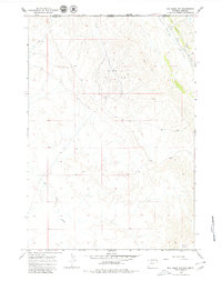
1966 Map of Elk Basin NW
USGS Topo · Published 1980About this map
Industrial development and physical geography meet at the Montana-Wyoming border in this mid-1960s study. The landscape is dominated by the Silver Tip Oil Field and the northern portion of the Elk Basin Oil Field, where numerous roads and a Drill Hole highlight the extraction activity of the era. These oil fields are situated amidst a rugged drainage system characterized by the Big Sand Coulee and Silver Tip Creek, showcasing the complex topography that workers navigated during the mid-century petroleum boom.
Find a feature on this map
9 named features on this map. Tap any name to fly to it.
Don’t see what you’re looking for? This feature index may not catch every label — zoom into the map to look around manually.
Map Details
Editions of this 1966 Elk Basin NW Map
2 editions found

Other maps of this area

1944 · Red Lodge
USGS Topo · 1:62,500

1950 · Clark
USGS Topo · 1:62,500

1954 · Billings
USGS Topo · 1:250,000

1955 · Cody
USGS Topo · 1:250,000

1957 · Billings
USGS Topo · 1:250,000

1958 · Billings
USGS Topo · 1:250,000

1958 · Cody
USGS Topo · 1:250,000

1962 · Cody
USGS Topo · 1:250,000

1966 · Elk Basin SW
USGS Topo · 1:24,000

1966 · Elk Basin
USGS Topo · 1:24,000