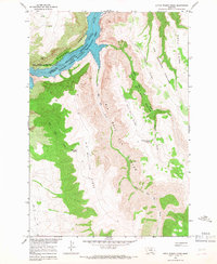
1964 Map of Little Finger Ridge
USGS Topo · Published 1967About this map
Yellowtail Reservoir dominates the northwestern corner of this map, filling the dramatic depths of Bighorn Canyon shortly after the construction of the Yellowtail Dam. The landscape is defined by the sharp transition from the water's edge to the high plateaus of the Crow Indian Reservation. Distinctive terrain features such as The Buffalo Pasture and Little Finger Ridge overlook a complex system of drainages, including Big Bull Elk Canyon and Little Bull Elk Canyon. Remote resources like Black Tail Spring and Whiskey Coulee Spring are marked along these steep ridges, providing a glimpse into the hydrography of this Montana backcountry. The presence of a Natural Bridge and the Jeep Trail winding through the southwestern quadrant reflect the era's land use within the Bighorn Canyon National Recreation Area during the mid-1960s.
Find a feature on this map
21 named features on this map. Tap any name to fly to it.
Don’t see what you’re looking for? This feature index may not catch every label — zoom into the map to look around manually.
Map Details
Editions of this 1964 Little Finger Ridge Map
This is the sole edition of this map. No revisions or reprints were ever made.
Other maps of this area

1894 · St. Xavier
USGS Topo · 1:125,000

1901 · St. Xavier
USGS Topo · 1:125,000

1954 · Billings
USGS Topo · 1:250,000

1954 · Hardin
USGS Topo · 1:250,000

1957 · Hardin
USGS Topo · 1:250,000

1957 · Billings
USGS Topo · 1:250,000

1958 · Billings
USGS Topo · 1:250,000

1958 · Hardin
USGS Topo · 1:250,000

1964 · Two Point
USGS Topo · 1:24,000

1964 · Peyote Point
USGS Topo · 1:24,000