
1964 Map of Peyote Point
USGS Topo · Published 1967About this map
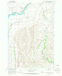
Bighorn Canyon National Recreation Area dominates this mid-1960s landscape, centered on the precipitous geography of Black Canyon. The survey illustrates a transition in land use, showing the early years of the Yellowtail Reservoir alongside traditional mountain landmarks and rugged pack routes. The inclusion of the Absaloka Youth Camp and Hunter Cabin provides a human anchor to an otherwise sparsely populated terrain of deep canyons and high ridges. Significant elevation changes are marked by features like Peyote Point and War Man Mountain, while smaller water sources such as Arrowhead Spring and Hunter Spring hint at the locations essential for travelers using the Soldier Trail (Pack) or navigating The Buffalo Pasture. The map also documents a Gaging Station, reflecting the systematic monitoring of the Bighorn River watershed during the development of the Missouri River Basin.
Find a feature on this map
23 named features on this map. Tap any name to fly to it.
Don’t see what you’re looking for? This feature index may not catch every label — zoom into the map to look around manually.
Map Details
Editions of this 1964 Peyote Point Map
This is the sole edition of this map. No revisions or reprints were ever made.
Other maps of this area

1894 · St. Xavier
USGS Topo · 1:125,000

1901 · St. Xavier
USGS Topo · 1:125,000

1954 · Billings
USGS Topo · 1:250,000

1954 · Hardin
USGS Topo · 1:250,000

1957 · Hardin
USGS Topo · 1:250,000

1957 · Billings
USGS Topo · 1:250,000

1958 · Billings
USGS Topo · 1:250,000

1958 · Hardin
USGS Topo · 1:250,000

1964 · Two Point
USGS Topo · 1:24,000
1964 · Mountain Pocket Creek
USGS Topo · 1:24,000