
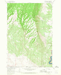
1964 Map of Red Pryor Mountain
USGS Topo · Published 1967About this map
Custer National Forest encompasses the high-elevation terrain of the Pryor Mountains, where deep limestone canyons and prominent peaks dominate the landscape. In the mid-1960s, this area of Carbon County was a site of active geological exploration, evidenced by numerous named prospects and operations such as the Old Glory Mine, Sandra Mine, and the curiously named Swamp Frog Mine. The topography is defined by dramatic vertical relief, with Red Pryor Mountain rising above unique features like the Red Pryor Ice Cave and Keyhole Cave.
Find a feature on this map
32 named features on this map. Tap any name to fly to it.
Don’t see what you’re looking for? This feature index may not catch every label — zoom into the map to look around manually.
Map Details
Editions of this 1964 Red Pryor Mountain Map
This is the sole edition of this map. No revisions or reprints were ever made.
Other maps of this area

1954 · Billings
USGS Topo · 1:250,000

1955 · Cody
USGS Topo · 1:250,000

1957 · Billings
USGS Topo · 1:250,000

1958 · Billings
USGS Topo · 1:250,000

1958 · Cody
USGS Topo · 1:250,000

1962 · Cody
USGS Topo · 1:250,000

1964 · Big Ice Cave
USGS Topo · 1:24,000

1964 · Sykes Spring
USGS Topo · 1:24,000

1964 · East Pryor Mountain
USGS Topo · 1:24,000
1964 · Mystery Cave
USGS Topo · 1:24,000