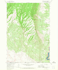
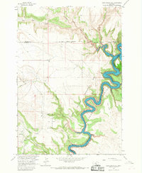
1964 Map of Mystery Cave
USGS Topo · Published 1968About this map
The Pryor Mountains dominate this high-elevation landscape along the border of Montana and Wyoming, characterized by a complex network of subterranean systems and deep drainage channels. The area is notable for its concentration of named caverns, including Mystery Cave, Royce Cave, and the descriptively named Four Eared Bat Cave. To the east, the terrain drops sharply toward the Bighorn Canyon, where the newly formed Yellowtail Reservoir follows the winding course of the Bighorn River along the edge of the Crow Indian Reservation.
Find a feature on this map
29 named features on this map. Tap any name to fly to it.
Don’t see what you’re looking for? This feature index may not catch every label — zoom into the map to look around manually.
Map Details
Editions of this 1964 Mystery Cave Map
4 editions found
Other maps of this area

1954 · Billings
USGS Topo · 1:250,000

1955 · Cody
USGS Topo · 1:250,000

1957 · Billings
USGS Topo · 1:250,000

1958 · Billings
USGS Topo · 1:250,000

1958 · Cody
USGS Topo · 1:250,000

1962 · Cody
USGS Topo · 1:250,000

1964 · Big Ice Cave
USGS Topo · 1:24,000

1964 · Red Pryor Mountain
USGS Topo · 1:24,000
1964 · Dead Indian Hill
USGS Topo · 1:24,000

1964 · Sykes Spring
USGS Topo · 1:24,000