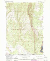
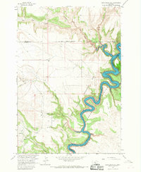
1964 Map of Mystery Cave
USGS Topo · Published 1988About this map
The Pryor Mountain Wild Horse Range dominates the western half of this landscape, a high-relief terrain characterized by limestone outcrops and deep drainages like Lost Water Canyon. This 1964 survey, later updated with 1980s data, highlights the complex subterranean geography of the area, featuring named landmarks such as Mystery Cave, Royce Cave, and the uniquely named Four Faced Bat Cave. To the east, the terrain drops sharply into the Bighorn Canyon National Recreation Area, where the Bighorn River cuts through the canyon floor. The map records the intersection of wildlands and early recreational infrastructure, noting the Layout Creek Ranger Station and several mining prospects that suggest the region's history of mineral exploration prior to its preservation as a national recreation site.
Find a feature on this map
26 named features on this map. Tap any name to fly to it.
Don’t see what you’re looking for? This feature index may not catch every label — zoom into the map to look around manually.
Map Details
Editions of this 1964 Mystery Cave Map
4 editions found
Other maps of this area

1954 · Billings
USGS Topo · 1:250,000

1955 · Cody
USGS Topo · 1:250,000

1957 · Billings
USGS Topo · 1:250,000

1958 · Billings
USGS Topo · 1:250,000

1958 · Cody
USGS Topo · 1:250,000

1962 · Cody
USGS Topo · 1:250,000

1964 · Big Ice Cave
USGS Topo · 1:24,000

1964 · Red Pryor Mountain
USGS Topo · 1:24,000
1964 · Dead Indian Hill
USGS Topo · 1:24,000

1964 · Sykes Spring
USGS Topo · 1:24,000