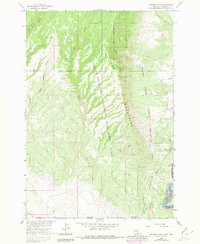
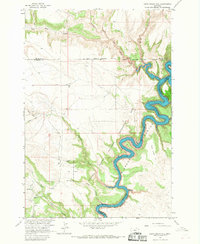
1964 Map of Mystery Cave
USGS Topo · Published 1980About this map
The Pryor Mountains define this landscape along the border of Montana and Wyoming, where the high-altitude terrain is marked by a unique concentration of subterranean features. This 1964 survey, with purple-ink revisions from 1978, illustrates the complex topography of Bighorn Canyon and the surrounding wilderness. The map highlights the Pryor Mountains National Wild Horse Range, a significant administrative boundary that overlaps with the Custer National Forest and the Bighorn Canyon National Recreation Area. For those studying the geological or recreational history of the region, the map identifies specific landmarks like Mystery Cave, Royce Cave, and the Four Eared Bat Cave. To the southeast, the Bighorn River flows into Bighorn Lake within the Crow Indian Res, where the canyon floor meets the rising peaks of Yellow Hill.
Find a feature on this map
30 named features on this map. Tap any name to fly to it.
Don’t see what you’re looking for? This feature index may not catch every label — zoom into the map to look around manually.
Map Details
Editions of this 1964 Mystery Cave Map
4 editions found
Other maps of this area

1954 · Billings
USGS Topo · 1:250,000

1955 · Cody
USGS Topo · 1:250,000

1957 · Billings
USGS Topo · 1:250,000

1958 · Billings
USGS Topo · 1:250,000

1958 · Cody
USGS Topo · 1:250,000

1962 · Cody
USGS Topo · 1:250,000

1964 · Big Ice Cave
USGS Topo · 1:24,000

1964 · Red Pryor Mountain
USGS Topo · 1:24,000
1964 · Dead Indian Hill
USGS Topo · 1:24,000

1964 · Sykes Spring
USGS Topo · 1:24,000