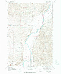
1969 Map of Hollenbeck Draw
USGS Topo · Published 1972About this map
The Clarks Fork Yellowstone River dominates this landscape along the border of Montana and Wyoming in the late 1960s. The map illustrates a complex irrigation and water management network essential to the high plains, featuring the Wills Canal, Doctor Ditch, and Sirrine Ditch. These waterways support the arid ranching and farming terrain between the Carbon Co Park Co line. Local history and genealogy are anchored by the Belfry Cem and Chance Cem, while industrial activity is noted through scattered gravel pits and a Gaging Sta along the river. Distinctive natural drainages like Hollenbeck Draw and Big Sand Coulee carve through the topography, alongside smaller features like the V O Reservoir and Monroe Res.
Find a feature on this map
27 named features on this map. Tap any name to fly to it.
Don’t see what you’re looking for? This feature index may not catch every label — zoom into the map to look around manually.
Map Details
Editions of this 1969 Hollenbeck Draw Map
2 editions found
Other maps of this area

1944 · Red Lodge
USGS Topo · 1:62,500

1950 · Clark
USGS Topo · 1:62,500

1954 · Billings
USGS Topo · 1:250,000

1955 · Cody
USGS Topo · 1:250,000

1957 · Billings
USGS Topo · 1:250,000

1958 · Billings
USGS Topo · 1:250,000

1958 · Cody
USGS Topo · 1:250,000

1962 · Cody
USGS Topo · 1:250,000

1966 · Elk Basin NW
USGS Topo · 1:24,000
1969 · Tolman Flat
USGS Topo · 1:24,000