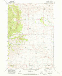
1969 Map of Tolman Flat
USGS Topo · Published 1972About this map
The Montana-Wyoming border cuts directly across this high-plateau landscape, where the open expanses of Tolman Flat meet the rising eastern edge of the Custer National Forest. Mapped in the late 1960s, the terrain is defined by a series of steep drainages and flat-topped mesas like Dilworth Bench. Evidence of early 20th-century industry and community is preserved in labels for the Grove Creek Mine and the Tolman Cem, while the reliance on scarce water is visible through numerous named water sources such as Three Corner Spring, Corner Spring, and a Well near Ruby Creek. A network of jeep trails provides the only access into the western high country, tracing the divides between Wolf Creek and the South Fork.
Find a feature on this map
21 named features on this map. Tap any name to fly to it.
Don’t see what you’re looking for? This feature index may not catch every label — zoom into the map to look around manually.
Map Details
Editions of this 1969 Tolman Flat Map
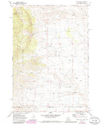
2 editions found
Other maps of this area

1944 · Red Lodge
USGS Topo · 1:62,500

1950 · Clark
USGS Topo · 1:62,500

1950 · Deep Lake
USGS Topo · 1:62,500

1954 · Billings
USGS Topo · 1:250,000

1955 · Cody
USGS Topo · 1:250,000

1956 · Mount Maurice
USGS Topo · 1:62,500

1957 · Billings
USGS Topo · 1:250,000

1958 · Billings
USGS Topo · 1:250,000

1958 · Cody
USGS Topo · 1:250,000

1962 · Cody
USGS Topo · 1:250,000