
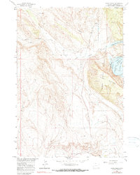
1964 Map of Sykes Spring
USGS Topo · Published 1968About this map
Sykes Canyon and the surrounding high country of the Bighorn Mountain range define this landscape in the mid-1960s, a period when the Bureau of Reclamation was actively reshaping the region's hydrology. The impoundment of the Bighorn River Yellowtail Reservoir is the central feature, creating the Yellowtail Res and transforming the canyon floor. This survey documents the emergence of the Bighorn Canyon National Recreation Area, showing early infrastructure such as a Gaging Sta and boat ramps at Horseshoe Bend. Away from the water, the map records the older agricultural and industrial footprint of Big Horn County through the Big Fork Canal and scattered resource extraction points like a Quarry and Prospect locations. Seasonal water sources like Sykes Spring and Britton Spring remain vital landmarks in the arid terrain between Gypsum Creek and Crooked Creek.
Find a feature on this map
19 named features on this map. Tap any name to fly to it.
Don’t see what you’re looking for? This feature index may not catch every label — zoom into the map to look around manually.
Map Details
Editions of this 1964 Sykes Spring Map
2 editions found
Other maps of this area

1954 · Billings
USGS Topo · 1:250,000

1955 · Cody
USGS Topo · 1:250,000

1957 · Billings
USGS Topo · 1:250,000

1958 · Billings
USGS Topo · 1:250,000

1958 · Cody
USGS Topo · 1:250,000

1962 · Cody
USGS Topo · 1:250,000

1964 · Kane
USGS Topo · 1:24,000

1964 · Red Pryor Mountain
USGS Topo · 1:24,000

1964 · Lovell Lakes
USGS Topo · 1:24,000
1964 · Mystery Cave
USGS Topo · 1:24,000