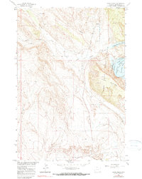
1964 Map of Sykes Spring
USGS Topo · Published 1990About this map
Bighorn Mountain and the deep incisions of Sykes Canyon dominate this landscape along the border of Wyoming and Montana. The 1960s marked a significant period of transformation for this terrain, as the Bighorn River was being impounded to form the Yellowtail Reservoir. Map details show the early development of the Bighorn Canyon National Recreation Area, including a distinctive river curve at Horseshoe Bend. Water management is central to the area's utility, evidenced by the Dew and Duffield Ditch and several named water sources like Britton Spring and Sykes Spring. Geologic exploration is present through scattered prospect markings and a quarry, while the drainage of Crooked Creek and Gypsum Creek illustrates the complex erosion patterns typical of this arid, high-relief environment.
Find a feature on this map
20 named features on this map. Tap any name to fly to it.
Don’t see what you’re looking for? This feature index may not catch every label — zoom into the map to look around manually.
Map Details
Editions of this 1964 Sykes Spring Map
2 editions found
Other maps of this area

1954 · Billings
USGS Topo · 1:250,000

1955 · Cody
USGS Topo · 1:250,000

1957 · Billings
USGS Topo · 1:250,000

1958 · Billings
USGS Topo · 1:250,000

1958 · Cody
USGS Topo · 1:250,000

1962 · Cody
USGS Topo · 1:250,000

1964 · Kane
USGS Topo · 1:24,000

1964 · Red Pryor Mountain
USGS Topo · 1:24,000

1964 · Lovell Lakes
USGS Topo · 1:24,000

1964 · Sykes Spring
USGS Topo · 1:24,000