
1969 Map of Bowler
USGS Topo · Published 1972About this map
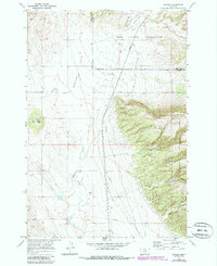
Bowler Flats dominates the western half of this landscape, where the high plains meet the rising eastern terrain of the Custer National Forest. This 1969 survey captures the small settlement of Bowler and the nearby Bowler Cem, situated along the eastern edge of the Crow Indian Reservation Boundary. The transition from the flatlands into the complex drainages of Pryor Gap and Sage Creek is marked by numerous resource exploration markers, including several labeled Prospect and Prospects, along with a specific Drill Hole near Black Butte.
Find a feature on this map
23 named features on this map. Tap any name to fly to it.
Don’t see what you’re looking for? This feature index may not catch every label — zoom into the map to look around manually.
Map Details
Editions of this 1969 Bowler Map
2 editions found
Other maps of this area

1954 · Billings
USGS Topo · 1:250,000

1957 · Billings
USGS Topo · 1:250,000

1958 · Billings
USGS Topo · 1:250,000

1967 · Castle Rocks
USGS Topo · 1:24,000

1967 · Section House Draw
USGS Topo · 1:24,000

1967 · Bluewater
USGS Topo · 1:24,000

1969 · Warren
USGS Topo · 1:24,000
1969 · Bear Canyon
USGS Topo · 1:24,000
1969 · Hunters Creek
USGS Topo · 1:24,000
1969 · Indian Spring
USGS Topo · 1:24,000