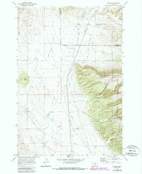
1969 Map of Bowler
USGS Topo · Published 1986About this map
Bowler Flats dominates the western portion of this 1969 landscape, where the small settlement of Bowler sits as a lonely hub of activity in southern Montana. The map reveals a high-elevation environment where the Indian Reservation Boundary cuts across the terrain, separating the Crow Indian Reservation from public and private lands. The presence of the Bowler Cem and several Prospects scattered near the Custer National Forest boundary speaks to the area's history of small-scale mining and early ranching life.
Find a feature on this map
25 named features on this map. Tap any name to fly to it.
Don’t see what you’re looking for? This feature index may not catch every label — zoom into the map to look around manually.
Map Details
Editions of this 1969 Bowler Map
2 editions found
Other maps of this area

1954 · Billings
USGS Topo · 1:250,000

1957 · Billings
USGS Topo · 1:250,000

1958 · Billings
USGS Topo · 1:250,000

1967 · Castle Rocks
USGS Topo · 1:24,000

1967 · Section House Draw
USGS Topo · 1:24,000

1967 · Bluewater
USGS Topo · 1:24,000

1969 · Warren
USGS Topo · 1:24,000

1969 · Bowler
USGS Topo · 1:24,000
1969 · Bear Canyon
USGS Topo · 1:24,000
1969 · Hunters Creek
USGS Topo · 1:24,000