
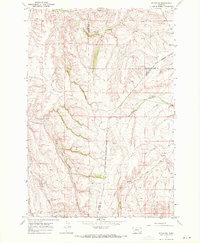
1967 Map of Castle Rocks
USGS Topo · Published 1971About this map
West Pryor Mountain dominates this Big Horn County landscape, situated entirely within the boundary of the Crow Indian Reservation. The terrain is characterized by dramatic elevation changes, notably the pass at Pryor Gap and the namesake formations of Castle Rocks. A legacy of earlier transportation is visible in the Old Railroad Grade, which winds through the mountain passes near a designated Tunnel. Geologic interest is high throughout this 1967 field survey, which identifies subterranean features like Pryor Creek Cave and Summit Creek Cavern. Hydrology is defined by several seasonal water sources, including Bird Creek and Pryor Creek, alongside man-made infrastructure like a prominent Pipeline and Ditch. A Lookout Tower and Picnic Area suggest the mid-century recreational and administrative use of this high-altitude territory.
Find a feature on this map
17 named features on this map. Tap any name to fly to it.
Don’t see what you’re looking for? This feature index may not catch every label — zoom into the map to look around manually.
Map Details
Editions of this 1967 Castle Rocks Map
This is the sole edition of this map. No revisions or reprints were ever made.
Other maps of this area

1954 · Billings
USGS Topo · 1:250,000

1957 · Billings
USGS Topo · 1:250,000

1958 · Billings
USGS Topo · 1:250,000

1964 · Big Ice Cave
USGS Topo · 1:24,000

1967 · Deep Creek
USGS Topo · 1:24,000

1967 · Pryor
USGS Topo · 1:24,000

1967 · Deep Creek SW
USGS Topo · 1:24,000

1967 · Section House Draw
USGS Topo · 1:24,000
1967 · Pryor NW
USGS Topo · 1:24,000

1969 · Bowler
USGS Topo · 1:24,000