
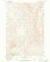
1967 Map of Deep Creek SW
USGS Topo · Published 1971About this map
The high elevation drainages of the Big Horn Mountains define this mid-century survey of the Crow Indian Reservation. The landscape is dominated by a complex network of seasonal and perennial water sources, including Middle Creek in the north and the upper reaches of East Pryor Creek to the south. A notable geomorphic feature, simply labeled Crater, sits adjacent to Crater Lake, providing a distinct landmark in a region otherwise characterized by steep contour gradients and narrow canyons. Human presence is limited to an unimproved Jeep Trail that navigates the high ridges between Lost Creek and the surrounding draws. The map serves as a record of the area's hydrology before later climate shifts or land use changes, meticulously documenting numerous unnamed Springs and the vital Lost Creek Spring that sustained life in this arid upland terrain.
Find a feature on this map
11 named features on this map. Tap any name to fly to it.
Don’t see what you’re looking for? This feature index may not catch every label — zoom into the map to look around manually.
Map Details
Editions of this 1967 Deep Creek SW Map
This is the sole edition of this map. No revisions or reprints were ever made.
Other maps of this area

1954 · Billings
USGS Topo · 1:250,000

1957 · Billings
USGS Topo · 1:250,000

1958 · Billings
USGS Topo · 1:250,000

1964 · Big Ice Cave
USGS Topo · 1:24,000

1964 · East Pryor Mountain
USGS Topo · 1:24,000

1967 · Deep Creek SE
USGS Topo · 1:24,000

1967 · Castle Rocks
USGS Topo · 1:24,000

1967 · Deep Creek
USGS Topo · 1:24,000

1967 · Pryor
USGS Topo · 1:24,000
1967 · Chilkoot Coulee
USGS Topo · 1:24,000